SAGINAW AND MANISTEE DAMS; WATER RESOURCES FOR THE COMMUNITY OF WILLIAMS; REGIONAL LAKES (UPDATED 07/8/23)
COPYRIGHT; ALL RIGHTS RESERVED (5/10/22)
There is a common misconception that Williams, Arizona, is a dry and arid landscape, devoid of any water features. On the contrary, there are a number of lakes in the region, often man-made and serving to provide water during the seasonal dry months of the year. The area is covered with an abundance of Ponderosa pines and juniper trees, interspersed with meadows and clearings that are appropriately called parks. In addition to the lakes, the countryside is sprinkled with "tanks," small holding ponds, that provide water for the abundant wildlife, and to refresh the cattle and sheep that graze upon the grass.
The limited water resources of the area were needed by the growing community of Williams, the expanding Saginaw and Manistee mill, and the powerful Atlantic and Pacific Railroad. Without a community there would be no workers; without the mill or the railroad there would be little reason for the town to exist. Each entity came to realize one thing; they needed each other. Although competitive for what water rights could be claimed, they also cooperated when it was in their best interests. Despite all of the challenges, Williams would ultimately prevail.
If Williams was going to survive and thrive as a community, the issue of adequate water supplies needed to be addressed. A number of wells were developed within the township. Fred Nellis had a well near the American Legion Building, on the south side of Grant Avenue, and west of Fourth Street. This provided for his needs and developed into a water service for paying customers (Fuchs, 131.)
The Grand Canyon Hotel's water supply was provided by a well, located on the corner of Grant Avenue and Fourth Street. A water line was laid to the corner of Sherman Avenue and First Street. At this location were two tanks, connected by a pipeline to the hotel. This water supply system was built by C.E. Boyce.
In 1897 the Williams Electric Light and Power Company was located on Bill Williams Ave., just south of 6th Street. The company pump house and well were located on Sheridan Avenue, between 5th and 6th Streets. C.E. Boyce and J.C. Brown built the plant at this location.
Due to their ever-growing demand for water, the Atlantic and Pacific Railroad (soon to be the Santa Fe) began drilling wells as early as 1886. A railroad sponsored dam was built in 1887. Peach Springs, still in existence to this day, was the source of additional clean water for many years for the railroad and the town of Williams. (Fuchs 70, 79,82.)
The Santa Fe Dam was subsequently increased in size in 1892 and 1894. In 1901, the Santa Fe began a major rebuild of the dam, raising it an additional ten feet. The project was overseen by B. Lantry's Sons, contractors out of Strong City, Kansas. This work cost about $50,000 and doubled the capacity of the reservoir. The new construction blocked the original grade of the Saginaw Southern, then in operation and the main source of logs for the mill. This required the grade to be moved up-hill; the line passed the dam through a new cut just above the structure (Williams News, September 28, 1901.)
An early postcard/photograph of the Santa Fe Dam. Note the dam has been raised above the grade of the Saginaw Southern, located on the far side of the dam. The railroad relocated the line through a cut, just above the old grade. In the background is the Saginaw draw, where the two company dams were located (Postcard; author's collection.)
During the dry months, the city contracted for water from the railroad dam, supplementing the wells and other water sources. The lake water was not known for its taste; citizens preferred well water. In times of drought, water wagons were a common sight in Williams. In 1911-1912, a barrel of water was 50 cents, if you provided the barrel (Fuchs, 208.)
The Saginaw and Manistee was not idle in their pursuit of water. In 1898, The Saginaw Mill was supplied by water from a timber dam, "located eight-hundred feet to the south of the mill (Sanford Insurance Map, 1898.)" This was to become known as Saginaw Canyon, or Saginaw Draw on early maps, on the north slope of Bill Williams Mountain. This was one of the sources of mountain run-off into Cataract Creek.
Another private dam, the Caufman, was built above the timber dam, which the Saginaw leased in 1902. This formed a quasi-partnership that assumed ownership of the water rights to the Draw.
The Saginaw was also provided water from the Phelan Dam, located north of the mill property on Cataract Creek. Constructed by J.C. Phelan in 1896, this could hold 6 million gallons of water. The Saginaw leased the dam in the 1900s. In 1903, the Phelan Dam was breached by flooding from torrential rainfall, which also inflicted damage to the other dams in the area (Fuchs, 132.)
When the lease expired, the city began laying a water line to the Caufman Dam. This set the stage for an on-going dispute between the city and the company for the rights to the canyon's water. In 1917, the Saginaw re-asserted its water rights to the Saginaw Canyon. This water was needed for the mill's operations, including the on-site powerplants (one at the Main Mill, the second at the Box and Planing Mill.) The company "graciously" offered what water was left over, after the mills needs were met, to the city. The water rights issue was not settled until 1924, when a Federal Court ruled the town owned the water rights in the canyon.
In its ongoing quest for the precious liquid gold, the Saginaw rebuilt its lower dam in the canyon, possibly the large concrete structure that still exists to this day, hoping to catch the leaking water from the municipal dam located higher up the draw. The company also resorted to building earthen dams to create a small reservoir on Cataract Creek, running just to the west of the Planing Mill.
Years later in 1944, after the mill had closed, the city purchased the land with the two dams of the Saginaw and Manistee.
(Google Maps)
Lakes and Reservoirs near Williams:
Large blue lake to the northwest, is Cataract Lake County Park. South of Williams is the Santa Fe Dam and Reservoir; below Buckskinner Park is the City Reservoir, located in Saginaw Canyon. The Saginaw dams were located in this canyon.
The Santa Fe Dam and Lake.
. Located on Highway 73, Perkinsville Road, south of Williams. The Saginaw Southern Line can be seen on the far side of the lake. In the forefront is the spillway and judging by the large logs, there has been substantial overflows.
Looking East across the dam. Note the construction methods. There are indications of the rebuilds and height extensions made over the years. This is a substantially better built dam, in contrast to those of the Saginaw.
The railroad logging grade on the west side of the dam. You can walk at your leisure; be careful getting to this side as you may have to walk across the top of the dam or follow the access road through the ravine.
Near the dam, the original roadbed approached at a lower level than the access road.
Saginaw Draw, or Canyon is the ravine west of the Santa Fe Reservoir.
Buckskinner Lake is at the top of the canyon.
The municipal dam and water supply, located at the head of the canyon.
Remains of a dam can be seen in the canyon. The earthen dam is just below these remains.
This area is part of the watershed for Williams, and may be off-limits
The only reason for this documentation is for historical purposes. This area may now be off limits, and going near the structures will be dangerous. These images may inform you of the structure and thus satisfy your curiosity. Stay out of this area.
Remains of the earthen dam, lower end of canyon
This structure matches the description of the original wooden dam,
800 feet from the mill, having been later rebuilt and strengthened.

Bottom picture shows spillway area.
In 1918 the citizens of Williams could hear the sound of explosions in the vicinity of the Saginaw dams. This was not a portent that the "Great War" (World War I) had come to their community; instead, the spillways were being lowered at the dams. In late March, heavy rains had strained the dam structures. As a result, the company felt that the water levels needed to be lowered an additional eight feet. This required dynamiting the spillways through the hard volcanic rock. Once one dam's spillway was completed, the other one received the same treatment. All inhabitants and the mill site could rest easier knowing that the threat of a massive structural failure was reduced (Williams News, December 13, 1918.)

Remains of the larger dam, located above the earthen structure, which can be seen from earth orbit. The original structure was possibly the Caufman Dam, having been rebuilt by the Saginaw after 1908. The structure is built of concrete, reinforced by rails used as rebar. Height is about 50 to 100 feet; width at top 3 feet.
The only reason for this documentation is for historical purposes. This area may now be off limits, and going near the structures can be dangerous. These images may inform you of the structure and keep you from going into this area.
The backside of the dam. If you look closely, you can see stratified layers of concrete, laid one upon the other. The rails used in the construction run horizontally which each layer. In effect, it was a "wafer cookie" and not of a continuous pour commonly found in newer dams.
The concrete mixture was an aggregate mix, using the local gravel and rocks. Although reinforced with concrete bents on the frontside, the material lacked sufficient strength to endure. Note the cracks and overall eroded appearance.
The structure shows signs of a significant breach, whether deliberate or unintentional. A large portion of the center of the structure has been washed-away. Given the construction techniques, this was not built to last through the ages. These two structures are probably the ones purchased by the city in 1944.
The Saginaw logged this canyon.
REGIONAL LAKES
CATARACT LAKE

The West Cataract Reservoir, today known as Cataract Lake, was constructed from 1947
and completed in September 1948. The lake is situated to the northwest of Williams,
near the golf course. This is a day use area.
DOGTOWN LAKE
Dogtown Wash Reservoir, also known as Dogtown Lake, was completed in 1935 as a source of water for Williams. A filtration and chlorination plant was built on the corner of Hancock Avenue and 6th Street in Williams, to purify the water to the satisfaction of the town's citizens. The lake was found to have a porous bottom, which was improved in 1941 by an attempt to seal it with clay material (Fuchs, 261.)
Today, this lake provides an excellent opportunity to stay in an improved campground (fees are collected.)
COLEMAN LAKE
Coleman Lake
Close-up of Coleman Lake area.
Coleman Lake was established by Old T.A. "Dad Coleman," who homesteaded in the area, circa 1876, and built the first dam to contain the lake. He was one of the first in the area to be involved with the sheep industry (Fuchs, 86.) In 1917, the dam was raised, providing the lake with a depth of four feet. In October of that year, the Forest Service allowed homesites in the area.
In 1921-22 the Lake was the center of attention for development. The Coleman Lake Development Association replaced the Williams Development Association. Both had sought to improve the lake for picnicking, fishing and camping. Alas, although canals were dug the watershed for the area could not adequately fill the lake for boats.
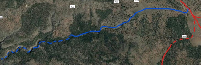
Today, the lake provides unimproved camping opportunities (no fees), and the chance to recreate in the clean air. The lake can be best described as seasonal, dependent on the annual rains for water. The lake can be accessed from Perkinsville Road; turn west at the well-marked sign onto FR108.
WHITE HORSE LAKE
In 1934, The Williams News supported the development of a dam near Sycamore Canyon. It was developed as a community dam, albeit eighteen miles from Williams. This was later taken over by the U.S. Forest Service. This became White Horse Lake, located in the Sycamore Game Reserve. Today, this is a well-known destination campground, remote yet reasonably convenient for those seeking a connection with nature. There are several forest roads that access the area. Check at the Williams Tourist Center for directions.
KAIBAB LAKE
Not to be forgotten is Kaibab Lake, located to the North of Williams along Highway 64. it offers fishing, hiking trails and improved campgrounds (fee collected.) Day use is free.
The earthen dam to the west of the lake. The reservoir is a source of water for the city of Williams.


Comments
Post a Comment