Tuesday, February 16, 2021

SAGINAW SOUTHERN, BIG SPRING CANYON BRANCH LINE

                             SAGINAW SOUTHERN, BIG SPRING CANYON BRANCH LINE

COPYRIGHT; ALL RIGHTS RESERVED (5/10/22)


Hidden within the forests are long-forgotten and overlooked evidence of the logging spurs. Many hours of hiking and research can slowly peel back the layers of time, revealing historically significant events. I will take a moment to express my appreciation to those who's research I have built upon. Without their efforts- Pat Stein, Vernon Glover, and one intrepid explorer who's name I know not- I would not be able to piece together the history of this line. Their maps formed the basis for my explorations.  

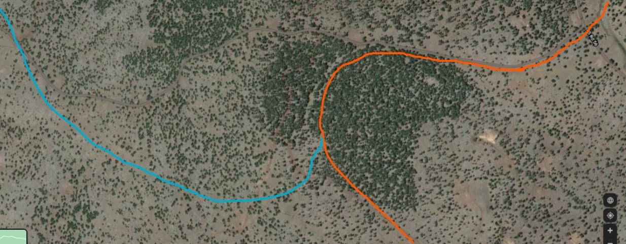
   South of Williams, Barney Flats is central to the railroad spurs fanning out into the woods. One such spur, the Big Spring Canyon Branch line, traversed flat lands and hills, followed the rocky bed of Big Spring Canyon, and ended west of Willow Spring.  All of the evidence indicates that this line was operated during the time period of the Saginaw Southern line. 


The line began just north of the Barney Flats Historical area, heading to the east, traversing around the northside of Barney Knoll. 


Looking west towards Bill Williams Mountain. The line crosses this area from Barney Flats. The grade can be difficult to find, but if you persist, you shall be rewarded 


Large park, or meadow, north of FR139. The line heads southeast, and is not readily seen. It is at this location that a spur heads north through a draw, entering Hyde Hill from the back, near FR48. All too soon this location will no longer be evident, as little remains of this spur.


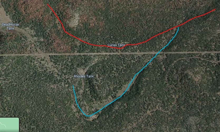
The line continues south, crossing FR139, generally follows FR217, descends a narrow valley, then turns East to Lucas Tank.


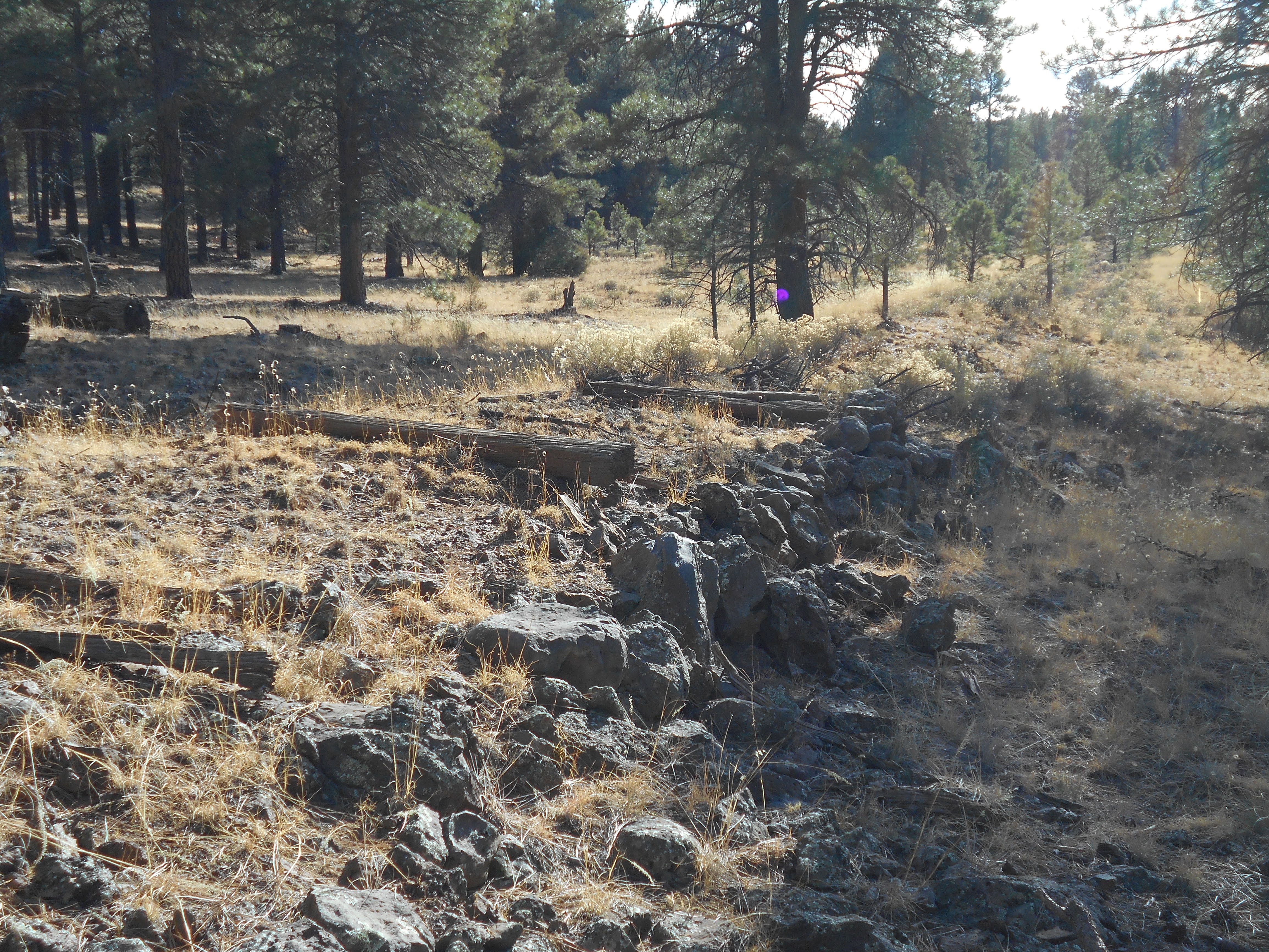
The grade descends into a narrow valley.


Remains in the narrow valley. Just above this location there appears to be a spur running along the slope. Only a faint outline exists, but there are a number of rock piles along the spur. I can only guess that they were anchor points for a steam donkey, or possibly supported telephone poles. There are ceramic insulators among the trees, suggesting that a telephone line ran to the Headquarters Camp.


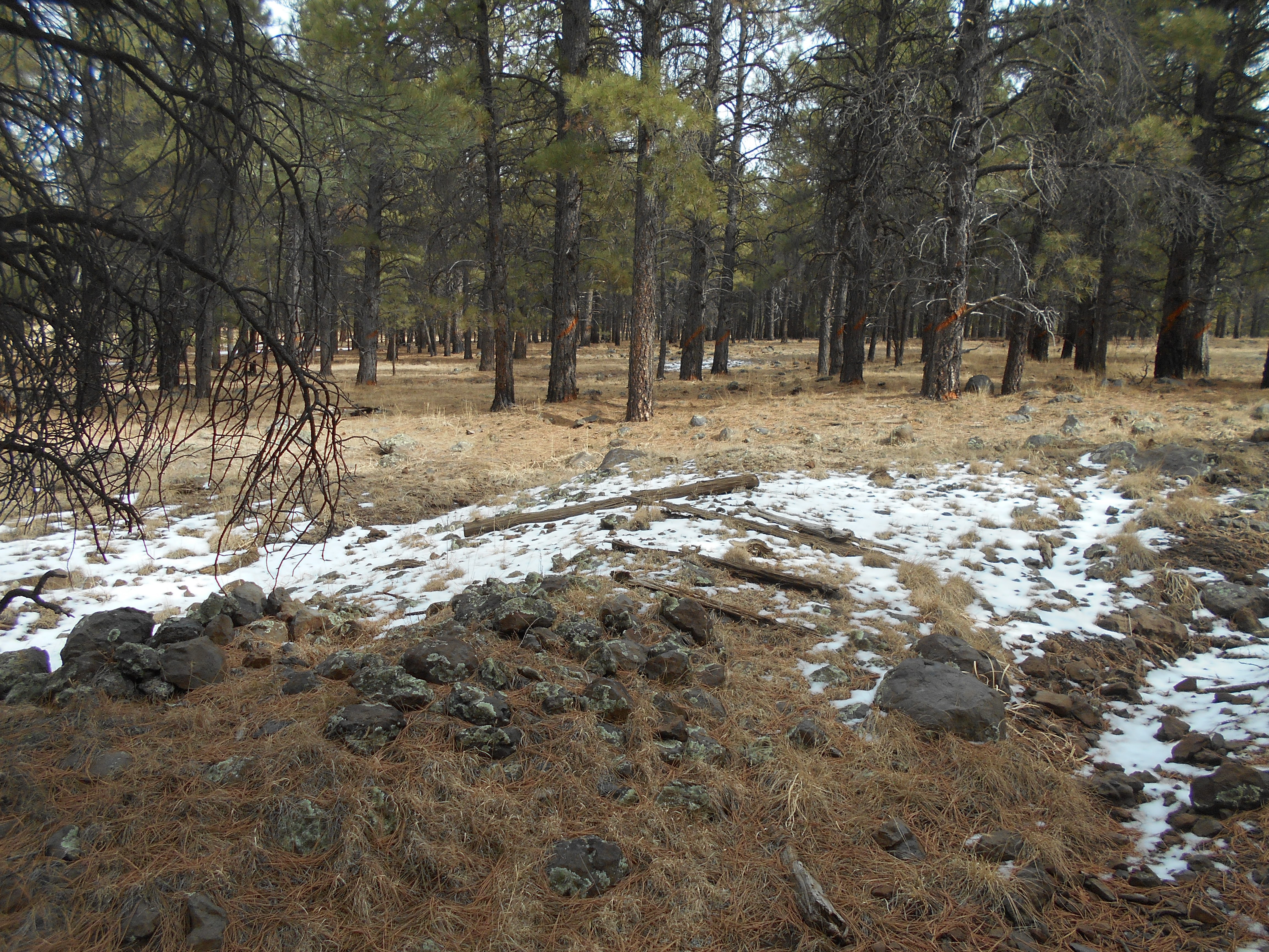
Lucas Tank. The grade passes just to the North of the tank, following the riverbed, which is barely visible in the photograph. Never said I was a professional photographer. Several sections where ties are still on the grade exist in the area. Forest Roads access the area, however they may be closed to vehicles.  


Passing just north of the tank, the roadbed descends east through Big Spring Canyon, until terminating  west of Willow Spring. The Big Spring Canyon line has all the appearance of an important operation, continuing for several years. There are camps located along the line; exact locations shall not be divulged.


Standard horseshoe found in the Canyon

An example of a cleated horse shoe, located at Barney Flats. The Saginaw took care of their horses. They provided horse shoes that matched the changing terrain, which suggests that they understood a well-shod horse is a productive horse. Pictures of the time suggest that the teamsters payed special attention to their steeds. Farriers and blacksmiths were available in the far flung camps.


Morgan Hill Spur

Two spurs connect with the main canyon line. One spur- the Morgan Hill spur- heads south-westerly into a small canyon, which opens into a meadow. The spur ends before a steep grade on FR2205 (a hiking trail not open to vehicles.) A number of artifacts remain along the path confirming the existence of the railroad grade. 


From the Canyon, looking South. The line followed a creek bed. Gradually, evidence begins to show that a line existed. Parts of the roadbed can be seen.  


Then, in a open area, rails are found resting on the forest floor. Upon closer inspection, the rails are in such good condition that they could be used again. Unusual that one, or two, can be found together. 
Although power lines cross near this point above the creek, they do not appear to have any connection to these historic finds. The rails were laying in such a manner that it was difficult to find a date or manufacture stamp.

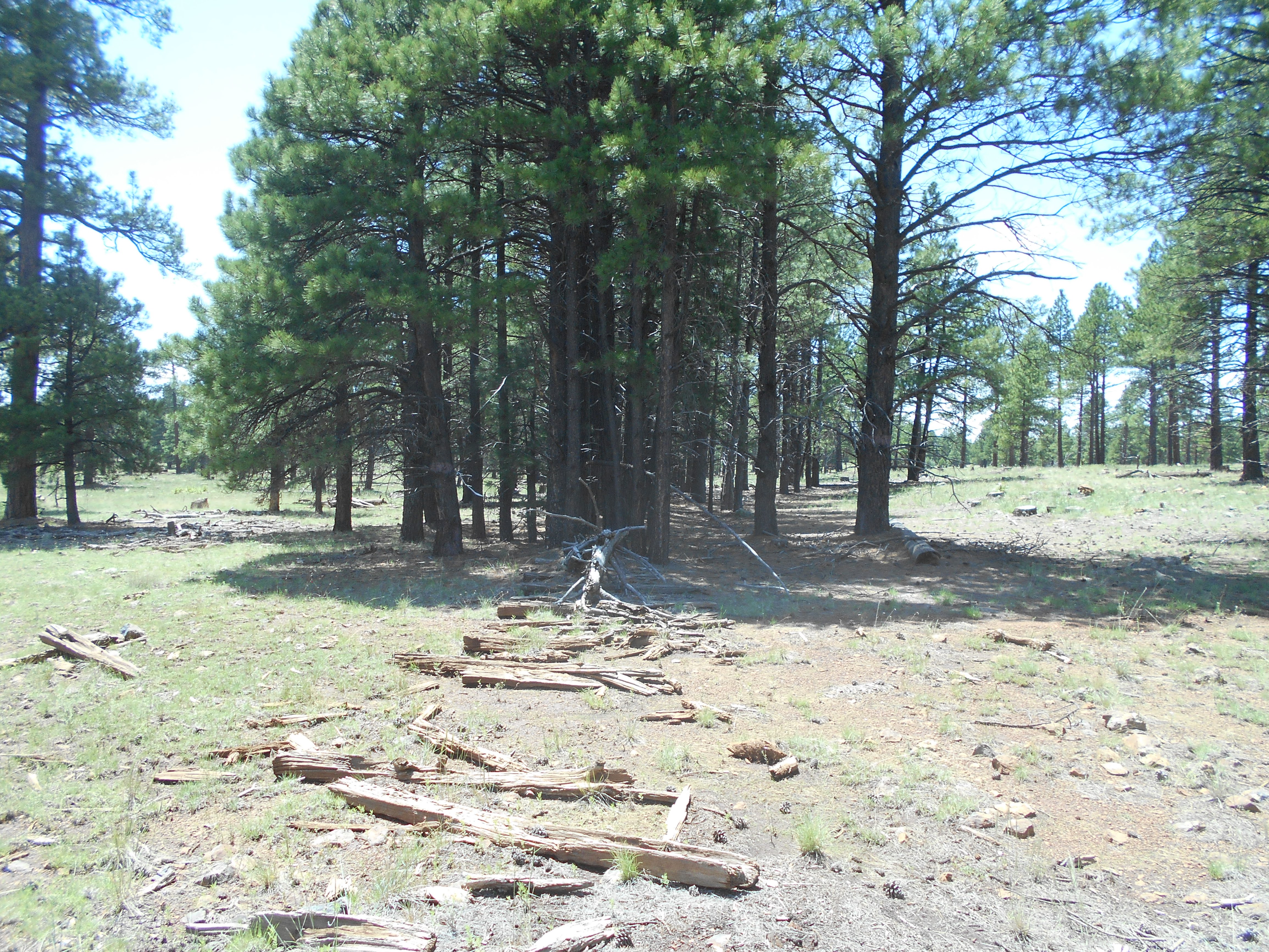
The creek opens up into a wide open area, replete with stumps and other indications of early railroad logging. This appears to be a stack of logs that were either left behind, or rolled off a log car. They were probably done with the spur when this happened, and felt it was not worth the effort to move the steam powered loader into position to reload the logs.  


The spur continues, until it ends-up in a dead end canyon. There is a forest road, FR2205?, that runs along the area, and is part of the old grade. At the far end the road continues up a very steep grade, to the top of a ridgeline. The logging spur appears to stop at this location. The Forest Road continues on, passing Dead Horse Tank, and eventually ending up at a trailhead located on FR139.
 

At the top of the ridgeline, looking towards Rhodes Tank. it is extremely rugged and dangerous area. If you are not careful, you can easily walk off a 200 foot cliff. Unless you are a very experienced hiker, stay on the trails.
Rhodes Tank. It is nestled at the bottom of a shear cliff, which I almost walked over. Follow my advise; the cliffs are very dangerous. The Tank can be accessed through a meadow area, south of Lucas Tank, and east of Dead Horse Tank. There are several ridges to be hiked over, but avoid getting lost by studying a good map before entering the area. Several forest roads access the area, most closed to vehicles. Nearby are a number of trees which were felled by the original loggers. Curiously, they were limbed and quartered, but were not hauled to the rail spur located near Lucas Tank, or to the spur at Morgan Hill.  

 Near the tank. I have found other logs, throughout the Saginaw empire, with this curiously odd square notch. If you have an idea what it was for, please inform me. 

Frog Tank Spur
The second spur connects with the Spring Canyon line, navigating a side canyon to Frog tank to the southwest. Both spurs traverse difficult terrain, with steep grades and high cliffs. The area should only be attempted by the most experienced hiker. 


The Frog Tank Spur follows the creek bed, passing a cabin/homestead site located on FR14B. 


 My findings and statements can be disputed or reinterpreted, depending on your viewpoint, until the New Creation. One thing that cannot be reinterpreted are the sections of rail found along the roadbed. Rails are significant archeological evidence. They confirm the existence of the spur, and also tend to point in the direction that the spur ran. Usually they were left by the track crew, having rolled of a flatcar. Rails were highly valued, and it is relatively rare to find one in the wilds. This one is located in the creek bed, south of the homestead.   


The spur continues on towards Frog Tank. There are indications that a passing siding was located along the line. Little remains of the spur, due to the tracklayer's proclivity to follow stream beds. Significant erosion has taken place, erasing much of the evidence. Part of the grade exists near Frog Tank. Having hiked around the area, it does not appear that the spur continued on past the tank. Ample stumps give testimony that they thoroughly logged out the area. Just South of Frog Tank another branch line ran was laid, but their is no indication that the two were in operation at the same time, or were connected. That other branch line will be covered in another post. 


*********

HEADQUARTERS CAMP
The Saginaw Canyon Headquarters Camp was extensive, covering some five acres. The location will not be revealed. Evidence indicates that someone, in the last hundred years, excavated the area, and fire has destroyed much of the combustible artifacts.  Remember, if you do stumble onto the site after a long exhausting hike, the area is protected, and disturbing the site can result in severe legal penalties. Trail cams and hunters protect the area.


A little gold panning?


One of the foundations for a structure. More than likely, the structures in this area were large canvas tents, with basic floors and low sidewalls to ward off forest denizens. 

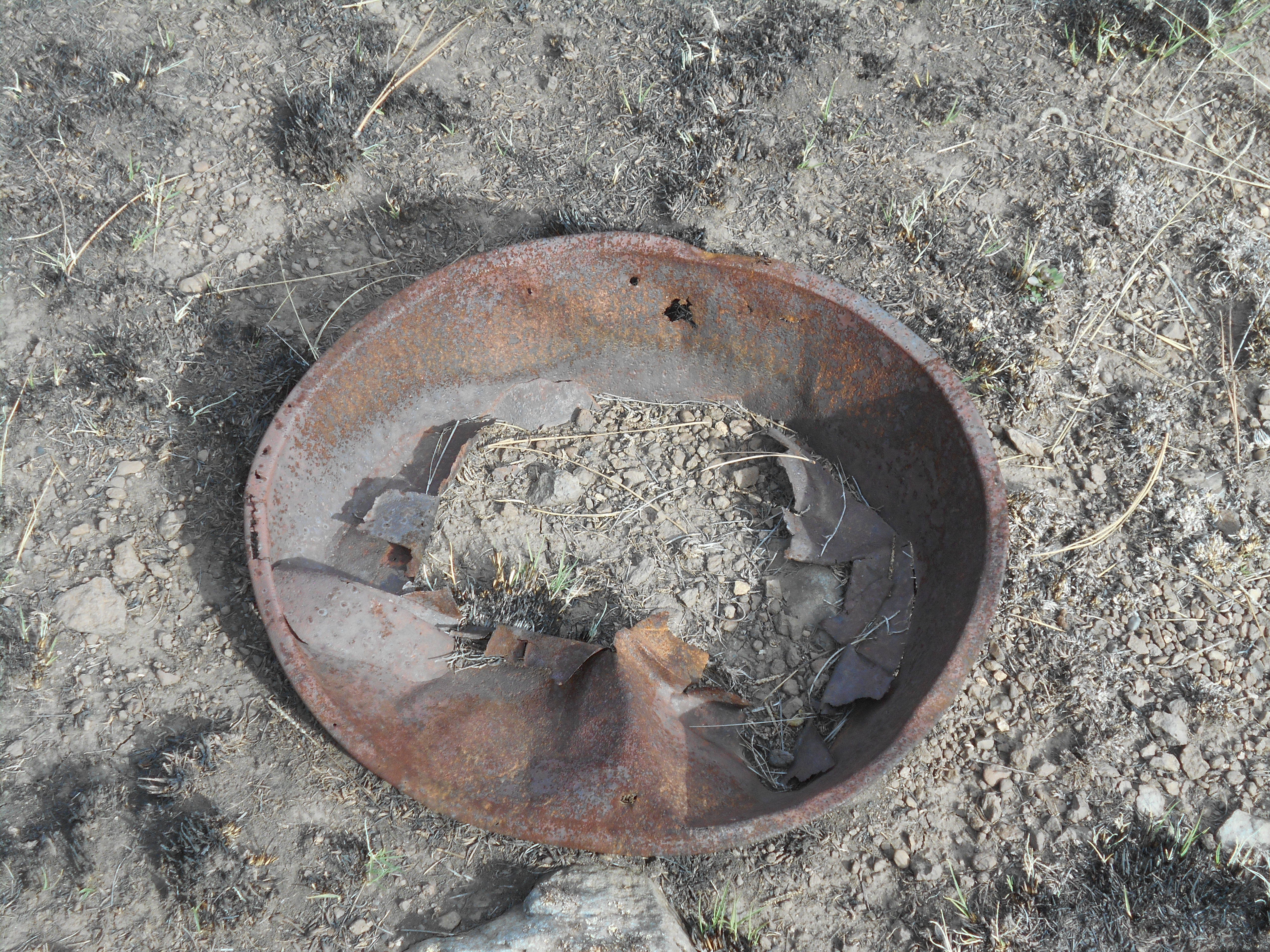
Cans in the trash dump date prior to 1920.  

A depression dug near the spur. These could be used as a cistern, or at one time had a structure built over the hole. They also could be used as a cellar to keep food cool, or to store explosives. 


A spur entered the camp area.  


There are a number of foundations made of timber and rocks located in the camp

Possibly a large foundation for a water tower. The streambed has an abundance of  year-round fresh water. The North Chalender and Bellemont lines required water to be shipped in from Williams.

Considering the size of the camp, the line was an important supplier of logs for the mill. The trash dump also gives support that the camp existed in this location for a number of years, more likely until the end of operations on the branch line. This line was over five miles in length, had at least two significant spurs, and provided access to timber holdings over a wide area.
 The use of a headquarters camp in the woods became a standard for future logging operations. Forest crews could live at the camp, remaining close to the work sites. Horses, along with the high wheel carts, could be maintained at one location. Early photographs indicate that  specialized tasks were performed on site, such as camp kitchens, blacksmiths, farriers, a small but adequate engine facility, and housing. Whatever might be needed from the Company mill or Commissary could be delivered by rail in one day. Later camps, and probably this one as well, could order supplies by telephone, or send a dispatch with the engine crew. The Company learned, adjusted and applied proven techniques resulting in greater production efficiencies. 

SATELITTE CAMP
There is one additional camp located on the line. It is relatively small in size, built for one purpose: to service the log trains at the top of a steep grade. All trains would need to have the brakes adjusted and inspected, before proceeding along the line. A pit  was dug under the rails, a curious feature that was mentioned by Stein in her reports. A closer look reveals that this would allow train crews to inspect the brakes on the log cars, with room enough to replace brake shoes. It is not uncommon to find old brake shoes and rigging sprinkled about the logging spurs. A simple inspection could save a costly and deadly runaway train accident. The camp would be just the size needed for a small workforce, and due to the absence of a significant trash dump, probably rode the trains back to the main camp at the end of the day.


Garland Prairie Branch Line; field research along the line

 Garland Prairie Branch Line: field research along the line

(This Blog was originally written as a book, which was never published. The author decided to use this format as a means to provide the information to the public as quickly as possible. And, quite frankly, railroad related books are just  not as popular as they once were. In order to appreciate the Blog, it is recommended to read the first posting. This includes the introduction and credits to those whom I owe a great deal of gratitude. Hopefully, this Blog will help to quench your thirst for local history, and enhance your next planned vacation)

The Saginaw and Manistee had large tracts of timber to the west, south and east of Garland Prairie. The company invested three years of planning and surveying prior to beginning of construction in 1924 (Stein, 37.) In comparison to the development of the Saginaw Southern Railroad, this was going to be the most thought-out and coordinated operation to date. The line reportedly continued until at least 1929. After much speculation, and researching an alternative mainline, the Saginaw and Manistee continued with past practice and contracted with the Santa Fe Railroad to transport log trains from the branch line to the mill in Williams (a more in-depth history on the proposed line can be found in prior postings.)


The Y at the Santa Fe connection

At the northwest corner of the prairie, the line connected with the Santa Fe Railroad.. A siding and wye were installed to turn S&M engines back to the forest.  From the connection with the Santa Fe, the line headed south, skirting the western edge of the prairie. Passing just east of Scholz Lake ( where the remains of a short rock fill grade can still be seen today), the line continued south, paralleling the creek bed. Just past FR13, the roadbed forks in two directions: one due East past the Dow Springs area; the second due West, across the creek and continuing on FR13.

               POWER LINE TANK AREA

The west spur crosses the creek  paralleling FR13 (several rock fill trestles are along this section).  At FR2130 the line curves southeast, eventually reaching Power Line Tank .  From this central point, a number of spurs fan out into the landscape.


The area is popular with weekend campers, most of whom do not understand 
the historical nature of the site. Besides the main grade that enters the area, there are the
 remains of at least three spurs into the woods. 


FR 565 (560?), looking towards the Tank.  


Near the Tank is a logging camp area, covering a number of acres. Apparently, they spread out the camp into several nearby locations, each likely specializing in certain activities. This area appears to be where they cut fire wood. As time goes by, more of the artifacts end up in the fire pits of modern campers. The grade is reasonably defined near the access road. Remember, this is a protected site. 


,  A line of stone piles are interspersed across the open meadow. At first, the reason for their existence puzzled me. After further investigation, I began to realize that these are the remains where telephone poles existed. This gives credence to my theory that the camps were connected by telephone to the main mill, providing coordination of the remote operations. Near the tank, you can still make out the foundations where portable cabins were located.


One spur curves to the North, another to the East, and a third (and possibly a fourth) curve to the South.
One thing that can be seen are logs left over from the operation. Although generally efficient, they did leave behind stacks of logs, or individual pieces that rolled off the log cars. This phenomena can be seen throughout the forest, wherever the spurs meandered.  


Just a short walk further at the end of the South spur, you come to a ledge overlooking the Sycamore Canyon Wilderness Area. Caution must be taken along the ledge, as the rocks can be very unstable. If you fall, the distance to the bottom is several hundred feet. It is a remote area.

. GARLAND PRAIRIE/SOUTH CHALENDER CONNECTION

One such spur is significant, as it turns west to connect with one of the old South Chalender grades (see South Chalender chapter.) Pat Stein speculated that such a connection existed, and I decided to take up the challenge and find the elusive spur. The West spur line, that splits from the main Garland Prairie branch line, follows FR13, until reaching FR21. It then follows FR 21 south. The spur splits near the junction with FR2130, with the connecting spur continuing South, while the other spur heads East, eventually reaching Power Line Tank. 


Traces of the grade can still be seen, yet in some places the skills of a mountain man are needed to follow the faint signs.


A wilderness hiking trail overlaps part of the grade. My maps indicate it is TR113. I found that the faint traces of the railroad grade were easier to follow than the trail. You need good tracking skills to follow this old trail, and it is highly recommended that the Forest Service re-mark the trail. You can easily get lost, and stray into the wilderness area.

The grade curves to the West


This spur connection curves then crosses FR13, heading West ( which can be seen along the north side of the road, running along the ridgeline.) Here can be found substantial roadbed and rockfill trestles, and a short spur into the woods. There a several short spurs along the grade, indicating these were used as loadout points for the steam powered loaders. Substantial-sized ties lie along the line, indicating they are from a latter time period than the original 1890s grade. The Thousand-Year storm caused significant damage to the remains, casting ties down the slope and washing out sections of the grade. 
    My theory is that the Saginaw reconnected with the old roadbed, then followed Rosilda Spring Canyon. This gave them access to vast timber reserves left untouched by the earlier 1890s grades. 

DOW SPRINGS TRAIL

Dow Springs Trail parking area highlighted in blue

 The East spur, after crossing a short rock fill trestle, continues east, passing the now-existing Dow Spring Trailhead parking area, located on FR131. A section of the ties and roadbed can be seen from the parking area. A trail takes the visitor west to a portable sawmill site, and eventually connects with the forest road across the creek. Stay on the trail, the area is rocky and you can get lost.  


             REMAINS OF PORTABLE MILL SITE


According to the Forest Service sign, the mill cut ties for the mainline railroad. This area appears to be where they cut to length the rough ties from the mill. The lumber would be laid across the bents, which formed a crude but simple benchlike platform. 


Rustic remains of a cabin, located along the trail. There are a number of debris fields where cabins once stood, whether they be sturdy log construction or portable logging structures. Whatever you may see look but don't disturb, appreciate but leave in their natural state.

*********


    As the main branch line continues East, it begins to split into numerous spurs, one of which curves North, bordering  the east side of the Prairie. Another spur heads southeast, entering the Railroad Spring area. This again splits, one spur heading due East, the other turning South, passing the Spring, eventually heading towards Grey Spring and points beyond. 

RAILROAD SPRING/TANK  AREA


The S&M used specialized camps on the line. Besides the headquarters camp, remote camps were located near Gray Spring, on the northeast spur, and at Powerline Tank. Not only did this plan shorten the distance to the worksites, it also reduced the demand for water at one location, thus enhancing sanitary conditions. 

    The railroad had petitioned the Forest Service to modify the Railroad Spring area. It was projected that from 200-300 persons would be inhabiting the location. In order to alleviate potential problems, the Tank would be modified to spread-out the camps. Two tanks today are connected by a canal.  If you visit, remember that the area is on private and Forest Service land, and has protected status.   

    Just North of Railroad Tank (Spring) the remains of a structure can be found. The remains are on the spur that heads due East, splitting from the main line.


Faint evidence of the line. As time passes, the grade slowly returns to a natural state- rocks, 
grass, and drifting soil. 


Much can be speculated about the purpose of the remains. At this location, the spur crosses a creek bed, necessitating some sort of structure to cross. Normally, they would use a rock fill trestle. However this appears to be a wooden trestle, more commonly associated with bents and such. If so, this would be one of the most unique structures that the Saginaw built. There are larger wooden trestles, such as at Hardy Hill, yet I have not found another wooden bent type trestle built to cross a creek bed. Then again, if they used a rock structure, it could have been washed out. The remains could be from a water tower structure. Finding such a relic is exciting for me, then again I have a simple mind satisfied by simple pleasures.  

GRAY SPRING AREA


Gray Spring area is located south of Railroad Spring, near FR527. Another scenic area
 blessed in the early years with an abundance of water. A satellite camp was located nearby, one of several that were maintained in order to spread out the impact of a large community of workers. This is an example of planned development, a direct result of the foresight of the Saginaw and Manistee Timber Company. Contrary to modern thinking, where it is assumed that logging companies were no more than reckless exploiters of nature's abundance, the Company planned for three years before building the Garland Prairie Branch Line. All of their prior knowledge and experience with other operations was applied, resulting in maximum and efficient production. It also helped that the Forest Service was involved in the process, unlike the early years of logging. The Company had to comply with additional regulations, as dictated by the State and County governments. The timber industry had evolved for the better.


Raised roadbed, heading towards the spring. The grade turns east, heading alongside of FR527. 
Farther east, the road becomes extremely rough


A debris field from a logging camp, near the road. This area is on private property, so be respectful. The camp's location is strategic, as at least three spur lines intersect with the main line here. 


A curious feature: there are a number of rock cairns near the main spur. A short spur appears to abut the area where the cairns are located. 


On closer inspection, there does not appear to be a post or other item in the center of the cairns. The rocks appear to be weathered and piled up for a long time. More than likely they date to the logging operations, which begs the question: what was their purpose? Is it possible they were anchor points for a log loader, or maybe a water tower? 


HEADQUARTERS CAMP

A large headquarters camp was located along the line. The camp included the "woods engine"(more than likely a Shay Locomotive) servicing area, a cook house, a tank for run-off water, a spur for water tank cars, and numerous other features such as portable cabin sites. Two other features are underground water pipes, and what appears to be a rudimentary septic system. The camp is spread out over a large area, as it remained in service for the duration of the line.  
At this time, I will not provide photographs or the location of the site. The area is near private homes, and more than likely is on private property. 


A stone cabin structure, overlooking a scenic vista of Garland Prairie and 
the San Francisco Peaks. It may not be railroad related, but it is one of many interesting features waiting to be found by the intrepid explorer 

Kendrick Peak Area; New Findings (FR9005G and FR9001E.)

KENDRICK PEAK AREA: NEW FINDINGS Map courtesy of Google Maps The general location of this map is off of Forest Road 549, accessible from the...