Saturday, July 1, 2023

SAGINAW AND MANISTEE, BELLEMONT LINE: NORTH OF KENDRICK PEAK, PART 2 (KENDRICK NORTHLINE: EAST BRANCH)

 SAGINAW AND MANISTEE, BELLEMONT LINE: NORTH OF KENDRICK PEAK, PART 2; SWITCHBACKS IN THE WOODS

(KENDRICK NORTHLINE: EAST BRANCH)

COPYRIGHT, ALL RIGHTS RESERVED

MAPS COURTESY OF GOOGLE MAPS (REGISTERED TRADEMARK)

Part two continues with the exploration of the grade north of Curley Seep Tank (this tank is covered more extensively in an earlier post, with its relationship to the Kendrick East Line on the east side of Highway 180.) Our starting point will be at FR9002F where the spur crosses the forest road (35.45768 N, 111.79329W.) All coordinates were taken by smart phone and should be used as a general reference only. Always have a good map with you at all times.


Keep a sharp eye out, as the roadbed at times becomes hard to define. You may even have to do a careful search pattern to pick up the trail. Always be careful stepping over down trees; a snake could be resting on the other side. I trod like a horse on paver stones, so they can easily pick up the vibrations as I approach.


As you approach the ridge line, the roadbed becomes more defined. 


The grade will cross several open areas. keep a keen eye where you trod. Now comes the surprise: there is a double switchback on this spur! As indicated on the map, the spur double backs and then descends the ridge (35.46055 N, 111.80009 W.). I certainly was excited; finding this in such a remote area indicated that this timber stand was worth the extra effort to build switchbacks. This region that the Saginaw logged has a number of switchbacks, which is unusual in comparison to other lines that they built. It tends to lead me to believe that there was a temporary change in engineers, and that the terrain required these special techniques to reach the timber. More on this theory in Part Three. 

View towards the first switchback 


The Ramp where the first switchback is located. Line splits to the right.


Looking towards the switchback lead. The switch lead track continues on for a short distance, estimated that this could hold a locomotive and four or five log cars


 End of the first switchback lead track. Definitely a lead spur, as the line did not continue along the ridge.

Downgrade from the first switchback. 
Grading and rock work define the roadbed


Evidence along the grade

This view is looking towards the second switch back (35.45911 N, 111.80020 W.)


Looking back where previous image was taken. 
The grade continues on the left

View looking along switchback lead track.


The lead track continues for a distance, until it dead ends in a box canyon. A great deal of slides and down trees were evident in the canyon. I did not see any indication of a water tower or tank, evidently the engine could carry adequate water for the journey from Curley Seep Tank. 


The line continues past the switchback and enters an open park area. There is evidence that two sidings were at this location.


The line ends near a forest road (35.45929N, 111.80164W.) I had driven this section of road, until it turned into a trail. At one time, it continued on and connected with the forest road at the top of the ridge. Little did I know that just a short walk away would be a Saginaw line. It takes persistence, research and a keen eye to locate these vanishing logging spurs in the woods. That's what makes it so interesting; "you never know what you might get in a box of chocolates (apologies to Forest Gump.)"


Parts 3 and 4 are soon to follow. 


HIDDEN HISTORICAL SITES IN THE WOODS: CAMPSITE NORTH OF KENDRICK PEAK

 HIDDEN HISTORICAL SITES IN THE WOODS: CAMPSITE NORTH OF KENDRICK PEAK

When traveling the side roads on the forest, I keep an eye open for signs of human occupation or activity. The smallest detail, a slight irregularity in the terra-ferma can lead to a fascinating discovery. This area caught my interest, having seen the imprint of what was once a side road, leading into the forest. Join me on this side trip, and how I came about my summary of this site.


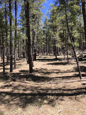
Several of these metal objects were in the area. They were placed inside low stone walls. These were identified as tent stoves, and the surrounding rock walls once protected the bottom of the tents. The next question would be; what era did they represent? These appear to be of more recent design, possibly 1950-60s. These tents were by nature temporary structures. It was odd that they were crushed, indicating this was not a hunter's camp, but possibly a construction or logging camp that lasted a season until the work was completed. The location (which shall remain unspoken) is remote, and whatever activity required the workers to remain on-site for periods of time. 


A steel barrel with several items, including a gasoline or kerosene can, 
and various other metal objects. 

A trash dump. On close inspection, this site included cans from various time periods, some dating prior to 1920, others more modern (1950-1960s.) This site was probably well-known for camping, and subsequent activity took place resulting in multi-layers of artifacts. 

This image shows what appears to be an old access road. At one time, 
this provided access to the camp area and the nearby woods. Having found all of these items, I began to walk a circular search pattern that included the nearby watershed and the forest road.

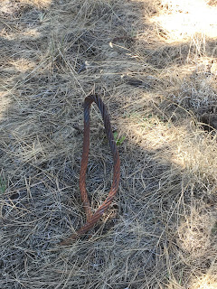
Interspersed over five acres were various artifacts, indicating logging activity. The logging cables appeared to have remnants of paint, and a newer clamp, indicating this was more recent. 


The cables were of various sizes, and left at different time periods

More cables, with additional clamps. Older cables were often looped and knotted only with cable, without clamps, which took a great deal of effort.  


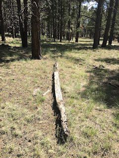
At the site was the remains of several long squarecut posts.


Although aged in appearance, the wood was shaped with more modern methods. It is possible that at one time this was used as a center pole on a large tent. 

What conclusions can be drawn from this site? It was likely used as a logging camp, possibly originating as a wood cutters camp for the Saginaw. Over time, it was reused again for the same purpose, and later became a camp area for public use.  Not necessarily a significant find, but an interesting site. For now, this will remain hidden in the forest, resting as time progresses. 


SAGINAW AND MANISTEE, BELLEMONT LINE: NORTH OF KENDRICK PEAK, PART 1

 SAGINAW AND MANISTEE, BELLEMONT LINE: NORTH OF KENDRICK PEAK, PART 1

(KENDRICK NORTH: EAST BRANCH)

COPYRIGHT, ALL RIGHTS RESERVED

MAPS COURTESY OF GOOGLE MAPS (REGISTERED TRADEMARK)

This post begins a multi-part series on the Saginaw's Bellemont Line, North of Kendrick Mountain. To simplify understanding, and avoid a very long title sequence, this series will henceforth be entitled either Kendrick North: West Branch, or Kendrick North: East Branch. If you have a forest map handy, these two branches split from the main Bellemont line near North West Tank, at Cowley Park. This area is on private property, and is beginning to be built up. Some of the lines in this area can  be seen from the road or accessed by forest roads. 

The west branch generally follows a northerly heading, passing along the base of the peak, past Crater Spring Tank and Crater Lake. The line becomes FR760, looping to the West of Horseshoe Hill, then intersects with FR191C (which is accessible from Highway 180.) FR 760 continues North, intersecting with FR90. More on this area on a later part of this series. 

The east  branch is a bit more challenging to find. The line at Cowley Park is difficult to follow, due to private property and closed roads. At Mudersbach Intersection, the line continues north-easterly along remote roads, eventually intersecting Highway 180 at FR191C. It then continues north along FR9007, until ending somewhere in the wilds of Arizona. This branch includes the Kendrick Park spur, the Curley Seep Tank spur, and others on the east side of Highway 180. Prior blog posts describe this area in more detail. 

There is a branch spur that passes through Curley Seep, on a northerly direction. A forest road covers sections of the roadbed and may be closed to motorized vehicles. I chose to park at the tank and walk the spur. I came out into the forest to get exercise and do research, not sit in the convenience of a vehicle. We should reconsider driving about in a quad vehicle, and rely more on walking in the wilderness. Coordinates given are for reference only, and should be varified by anyone accessing this area. 


This map provides an overview of the three spurs or lines that will be covered in this series. The area is relatively vast, covering many acres. The roads are rough, and not soon to be repaired so be prepared; drive a 4x4. Bring adequate water and supplies- I cannot emphasize this enough. 


The spur or line that is the topic of Parts 1 and 2. Part 1 will bring us from Curley Seep Tank to where the spur intersects with FR9002F. 


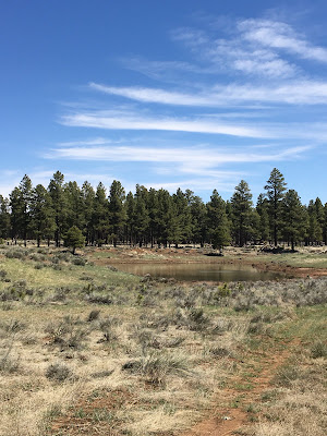
Curley Seep Tank, looking Northeast towards Highway 180. There is no direct access from the highway to the tank, and DO NOT park on the highway and hop the fence. You can  cause an accident or be towed. The cut in the tank berm for the logging spur can be seen on the left of the picture. 

A post in the ground helps to locate the general location of the spur/road.

Looking back towards the tank, the grade on the right of the image.

Decaying log and stump left by the early loggers.


The roadbed makes several turns. Just stay with the road, until you notice a rock fill ramp.


The ramp slops down. Just at the bottom you will see the grade turn to the left, leaving the road. 


A berm will be noticable, where the grade was built up to cross a small creek (35.46013 N, 111.78803W.)


The raised area has several noticable features, including rock fill and an occasional tie. 


Crossing the fill, the grade will continue until it enters an open park-like area.


The area is rather scenic, so stop and enjoy the view. 
Looking towards the Kachina and San Francisco Peaks.


The line will cross an open area, so keep a eye out for the grade. It is almost invisible at this point. 

At the point where the grade intersects FR9002F (35.45768 N, 111.79329 W.)
Part Two continues from this point. This road is accessible from the North. South of this point it is basically a quad road, or a very small 4x4.


Update

  I have been actively seeking out those hidden historical sites in the woods. Sometimes a hike in the woods ends up with no historical find...