PETROGLYPHS AND PICTOGRAPHS IN THE WILLIAMS, ARIZONA AREA: LAWS SPRING; HARDY HILL AREA; ROCK TANK/KEYHOLE SINK
PETROGLYPHS AND PICTOGRAPHS IN THE WILLIAMS, ARIZONA AREA:
LAWS SPRING; HARDY HILL AREA;KEYHOLE SINK
COPYRIGHT; ALL RIGHTS RESERVED (5/10/22)
Rock art, in the form of pictographs or petroglyphs, are in abundance in the Williams area. Often they contain directions, carry spiritual significance, or communicate other information. Whether you are a casual observer, an amateur archeologist, or a trained researcher, you cannot help but be curious as to their meaning. I focus on the information and directions that these symbols embody. They may appear simple in design, yet they are also complex in their meaning. Rock art, as I humbly would call it, conveys complex intelligence, and an expression of the remarkable ability of humanity to communicate with others. Such forms of language are found throughout the land we now call the United States. An early inhabitant of the South West would find commonality with the engravings found in the Pacific North West, and vise versa. One good resource is David Grant Noble's book "Ancient Ruins and Rock Art of the Southwest", Taylor Trade Publishing, 2015. He is one of those interesting people I hope to meet someday, out there in the wilds of Arizona. You never know what kind of character will cross your path.
These three locations- Laws Spring, Hardy Hill and Keyhole Sink- are associated with: springs; areas of good grazing for domestic animals; and an abundance of wildlife. Two of them- Laws Spring and Keyhole Sink- have parking areas and trails to the sites. All require hiking over rocky terrain, and some skill in following primitive trails. As with all such sites, they are protected and monitored. Due to the carelessness and vandalism of others, some day soon they may be closed to the public.
Today's adventure can be followed on the AZ GMU 7W Map, also known as Section 7W.
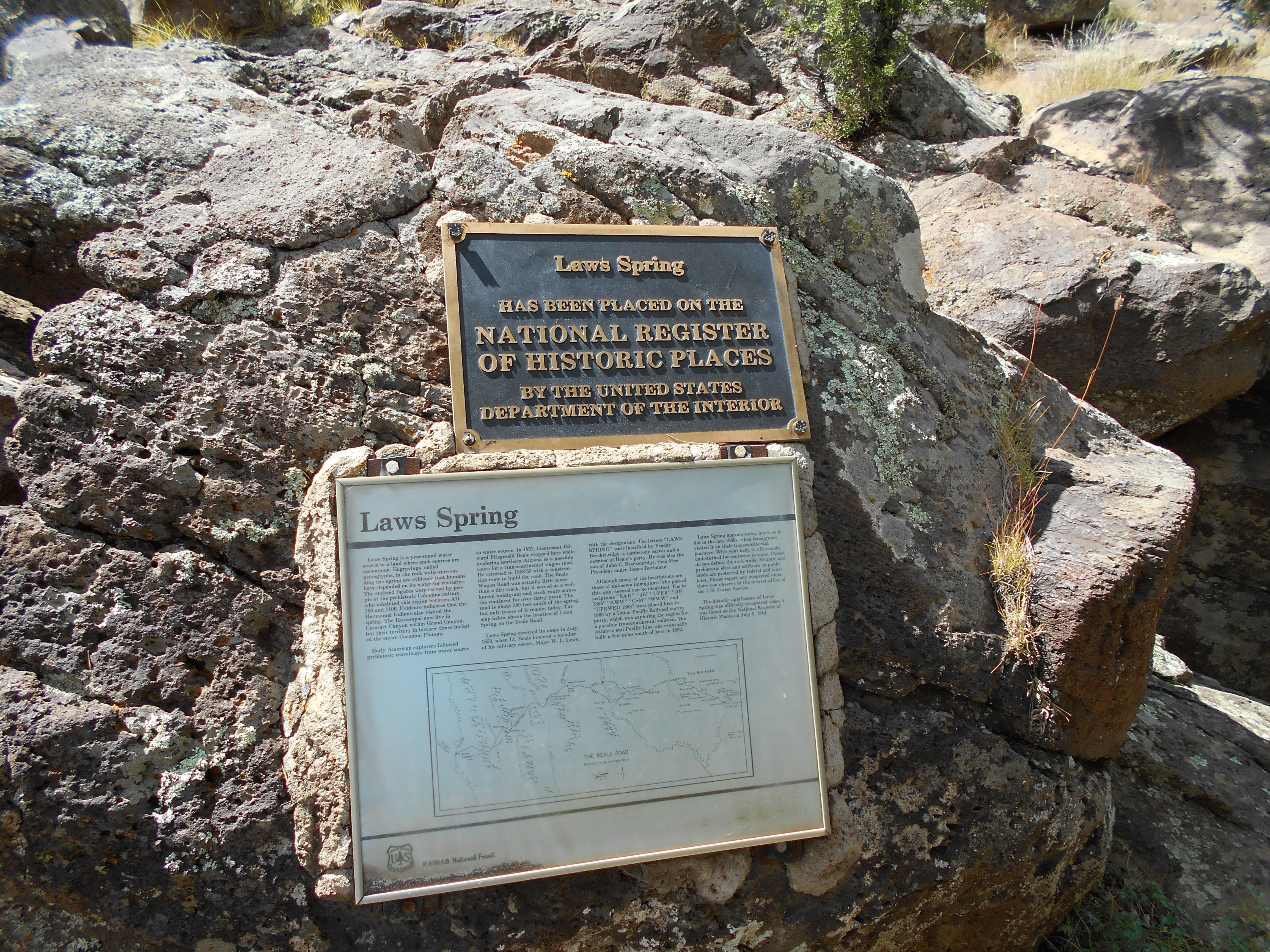
LAWS SPRING
Years ago, this was one of the first remote areas that I explored. It is difficult to find, but well worth the effort. The site is almost pristine, possibly due to it's remoteness. There is an overabundance of artwork, from early engravings to more contemporary graffiti. Please do not add your tidbit of self-importance. Respect the fact that those that came before you had to walk great distances, traveling from spring to spring, arriving at this small oasis and finding refreshment and rest.
Do your research before driving to the site. Check with the Visitor's Center in Williams. They have free copies of National Forest Maps which have the latest information on forest roads. This area is remote, and I know people who got lost, but through perseverance and great driving skills made it out before resorting to cannibalism for survival. You will need a 4x4 vehicle, and bring emergency supplies. The roads are rough, and if they appear to be too difficult turn around.
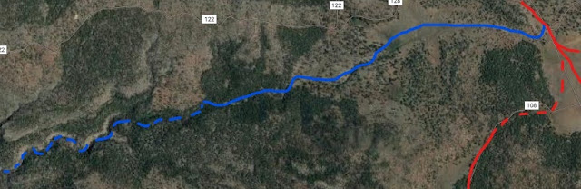
According to the map, Laws Natural Tank is near the intersection of FR2029C and FR2030. To access this area, take FR141, Spring Valley Road. Turn North, the only way you can turn, on FR730 (just West of Twin Tanks.) Follow it north past Wildcat Hill where the road becomes FR115. There should be a track on the left marked FR2030, or it may still have a sign saying Laws Tank. Again, have an updated map and get the latest directions. I have been there, but road numbers change at the whims of forest officials.
There is a parking area above the springs. Stay on the trail.

Trailhead sign. Stay on the trail; seems like a simple act, but if you stray you will get lost or injured. One of the fascinating features of the area is that the Beale Expedition visited this location. Original rock art can be found naming the spring, etched by one of the expedition members. There is a sketchy trail that leads to where the wagon road existed. In addition to the expedition, many a traveler paused and rested at this remote oasis, before moving on to the next stop along the road.


Comments
Post a Comment