BELLEMONT LINE NORTHERN AREA: SPURS ALONG FR549
COPYRIGHT; ALL RIGHTS RESERVED (5/10/22)
The FR523 exit is just to the north of the Cabin Flats area. The railroad line (designated in RED on the following map) continues from the switchbacks at the Cabin Flats location. The line generally follows FR523, then follows FR549 as it continues north. The old railbed is either on the forest road, or just to the West of the road. As the road continues north, several spurs and other features can be found. Access to the area is just off of Highway 180, and most of the main forest roads are in reasonably good condition, with the exception of the spurs off of the main line. A 4x4 vehicle is best used further north on the road, or in the Curley Seep Tank Area.
One Recreational Opportunity is to stay on FR523, and follow it as it curves around the hills and through the valleys. FR523 dead ends into FR514; take a right turn and follow it around the hill. you will come out where there is an awesome view of the Kachina Peaks. Following FR514 will take you back to Highway 180. Always have a map if my directions fail you. This is a very scenic road.
Please follow the directions on the signs. Remember; as stated in other posts, and continually repeated, do not destroy or desecrate historical sites.
RED designates the main S&M logging line. PURPLE designates the Curley Seep Tank spur.
LIGHT BLUE designates the FR9007G spur. DARK BLUE DESIGNATES "Y" and spur to the East. Map courtesy of Google
FR9007G SPUR
(LIGHT BLUE LINE ON MAP)
FR9007G is designated a closed road to motor vehicles. However, it is well marked and open for a hike. The road is about one mile in length, extending in a curve to the west of the main road. The Forest maps show this as a spur, and the general impression, owing to its curve and general features, is that this is true.
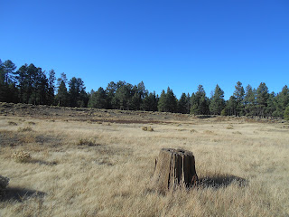
The road is a nice hike through the open meadow (park, in local terms.)
It curves towards the distant trees.
Several curious features are along the route. One is this rock and cement structure,
which protects an old drainage pipe. This gives support to two assumptions; that this was once a railroad spur, and that it was repurposed as part of the old highway. It is not uncommon to find early roads using abandoned railroad grades.
The road continues until it reaches a rocky ridge, where it then continues up and over
to the area of Highway 180. The ramp up the ridgeline (not shown) does not have the general appearance or construction of a feature built by the railroad. It has more of the appearance of one built for early automobiles. As such, I concluded that this spur ended, and did not continue to Curley Seep Tank, which is just on the other side of the highway. This tank had a separate spur, which will be covered later in this posting.
FR549 EST SPUR AND "Y"
(DARK BLUE ON MAP)
I think of this as one of the more significant features of this area. It is one of the few places where a "Y" can be found. This was used as a means to turn the steam engine around to face the other direction. It also indicates that this is near the end of the line. As an added feature, a spur continues some distance in an Easterly direction. One of those hiking adventures waiting to happen.
The spur, and one leg of "Y" can be seen to the right of FR549. The outline of this feature
can be seen from satellite photos, albeit faintly.
One leg of the "Y", looking at the intersection of the second leg.
The spur continues on past the first stand of trees, curving to the left.
Part of a tie with spikes along the railroad bed.
The spur continues on across the park, in an easterly direction. Although I visited the area in Autumn, the air was filled with smoke. This was due to the Forest Service conducting a controlled burn.
Note the numerous plastic cones that dot the park. These were meant to protect the young seedlings that were planted several years ago by the Forest Service. This was intended to reforest the area, hoping at least some of the seedlings would survive. I could not see any that lived. The weather conditions of Arizona can best be described as fickle. Many years ago, this same process was attempted at Barney Flats, with the same results. From my limited understanding of forest propagation, it would be better to gather and spread pine cones throughout the areas closest to the established trees. The seeds will germinate when nature is good and ready. Hopefully we all live and learn.
FR549 ROADBED AND TRESTLES
(DENOTED IN RED WITH WHITE HIGHLIGHTS ON THE MAP)
The trestles are located North of the "Y", in a shallow ravine. Just follow the road,
you will see them on the left.
The first rockfill trestle can be seen to the left of the road.
It can be easily reached by a short walk.
As can be seen from the photos, the trestle features are easily defined
The second rock fill trestle as seen from the road. The trestle once crossed a gulch, before continuing on in a northerly direction. I was just too lazy to get out and get additional pictures. I had rocky goat trails- that had little resemblance to a road- to endure in my near future. I suggest ending your northerly journey here, and look to other adventures. The railroad bed becomes obscured beyond this point.
CURLEY SEEP TANK(PURPLE LINE ON MAP)
The second most important feature of the area is the Curley Seep Tank Spur. The spur begins at FR549, just before FR9007G road. This intersection I did not find. Access to the tank must be done from FR191C (part of the Cabin Flats area.) Do not attempt to park on Highway 180, as it is dangerous to do so, and the roadsides are fenced. To find the roads from FR191C will require a good map, as most of them are poorly marked. I used FR9002F for part of the way, which is accessible from FR191C. You might have to hike in to the location.
Curley Seep Tank. The tank has been enlarged over the years, obscuring some of the 100-plus years of identifiable features. From all indications, this tank existed in some form during the time of the early loggers. This would have provided a source for ever-scarce water, needed for mechanical beasts and mortal ones as well. One commentary stated that there are indications the Southwest was much wetter back then. For every 100 years in the past, more springs and seeps existed, and the monsoon rains and snows were more regular.

Tank, looking West. There is a high embankment along the north-west side of the tank.
At the far end of the embankment can be seen a notch; this is where the roadbed lies.
At the notch, located on the far West side of the embankment, looking North. The roadbed can still be seen as it continues on towards Antelope Well, or Lava Tank. This will be next spring's adventure; finding the far northern end of the Bellemont Line. This will more likely mean an ambitious hike, culminating in finding that lost unicorn, the absolute final end of the line.
Looking Southeast, from the embankment.
The roadbed can barely be seen due to the thick grass.
A tie, providing definitive proof that this is the grade.
The spur passes through a shallow cut in the hillside. In the distance, the line curves to the left,
crossing Highway 180, and connects with the main line.
General overview of the area: It can be difficult to locate the old spurs,
yet with perseverance and research they can be found.


No comments:
Post a Comment