ROSILDA SPRING CANYON BRANCH LINE
COPYRIGHT; ALL RIGHTS RESERVED (5/10/22)
In 1921, three years prior to the building of the Garland Prairie line, a Saginaw and Manistee engineer began the survey of a roadbed that would connect the mill with the new timber holdings. With much fanfare and pride of accomplishment, the engineer announced the completion of his survey (MS 266 Series 3, Box 16 #140 Report on Proposed RR From Williams, 1921:NAU Cline Library, Special Collections.)
The proposed route had the advantage of the S&M controlling the haulage of timber by rail, cutting the Santa Fe out of any potential revenue. Most of the route would encounter grades that could be overcome by methods used in prior lines. The most difficult section (if the interpretation of the Forest Maps is correct), would be the Rosilda Spring Canyon area. They had used watersheds before, and this canyon presented the same challenges: roadbed subject to frequent washouts; steep canyon walls that created narrow passages; a multitude of curves; and short, steep grades. If the railroad chose this route, then the steam engines and equipment would need to be up to the task. According to an early map, the new line would require the building of two bridges within the Canyon; one at 450 feet, and the second at 100 feet.
The proposed line would begin at the south-end of the Garland Prairie Line, near Upper Hull Spring, and proceed westerly, paralleling FR13 and FR139. It would then enter Rosilda Spring Canyon, cross the Pouquette homestead, then circle west and paralleling FR132 and FR130, until connecting with the old Saginaw Southern Line. If the Saginaw Southern was once again revived as a common carrier entity, and by extension of incorporation be applied to the new line, the company could exercise condemnation rights on private lands. Legal application was attempted with the Arizona Corporation Commission (Stein, 37.)
A year later, the same surveyor and engineer changed his professional mind. His remaining enthusiasm was expended on a second alternative. This route would be confined to the Garland Prairie area, with a connection with the Santa Fe. Part of his proposal was the expectation of reduced rates charged by the Santa Fe (Stein,37.) Much can be speculated as to why the engineer had so dramatically changed his opinion. Whatever the reasons, the directors of the S&M accepted the second recommendation, and began preparations to build the Garland Prairie Line south from the Santa Fe connection.
Interesting enough, evidence suggests a logging spur did at one time exist in the Rosilda Spring Canyon. Just west of Moose Ranch is Rosilda Spring. Artifacts, including ties and the appearance of grades, indicate that a Canyon spur existed. At the far end of the Canyon, at Rancho Viejo Tank, the remains of a log loadout and rail-related artifacts exist. Ties indicate a spur was laid heading south from Rancho Viejo Tank, into a dead-end canyon. The main branch could have continued to the west, crossing the Pouquette Homestead. Time has erased most of the visible evidence. To the east of the Tank, ties and other detritus (inclusive of stumps and cut logs) exist within the Canyon.
In January of 2021, I began my quest to confirm the theory that a logging grade had existed through the canyon.

Heading West from Rosilda Spring
CABIN, WAGON ROAD AREA
It takes persistence, dedication and a great deal of searching to find remnants of the past. Sometimes you find the unexpected; a serendipitous experience that provides a moment of joyous celebration- giving hope of greater things to be found. A side canyon revealed what I defined as a wagon road, winding its way up the hillside.


Along the road were the unexpected remains of a cabin-like structure.

Further investigation revealed that the notches were hewn with an ax. A great deal of effort was expended to build this structure. The structure need not have a roof, or be high enough to provide walls. Often the old pictures show that the logging camps built structures with low walls, surrounding a canvas tent in the center. This provided some protection from the denizens of the forests, and the weather common to the area. Similar structures have been located near other logging operations. The cabin's age lends interpretation that the road was a wagon road; the cabin thus owes it's existence to the road. It is possible that the road was used by the "big wheel" logging carts (or wagons), bringing the valuable logs to the railhead in the canyon.

My humble interpretation is that the structure was used by the teamsters for shelter, after a hard days work. They would also need a site to store feed, grain and supplies for the horses. Further up the road are the remnants of a tank or cistern, which could be used for watering the horses.
View from the cabin, towards the road
Back in the main canyon, the adventure continued
The canyon narrows at several points, making for a difficult hike. Then it opens to a park-like setting. Dogged perseverance is usually rewarded. My prior experience with the Saginaw showed that they liked to take the path of least resistance, meaning that they followed riverbeds. This allowed for ease of construction and quick access to to an area. The drawback is, the roadbeds can be easily washed out owing to the frequent monsoons. More permanent grades, lasting more than one season, required substantial preparation. My general theory was that the grade could be found along the riverbed. This presented the problem of hiking and climbing over boulder-strewn dry riverbeds. Although artifacts in the form of ties, stumps and cut logs were being found, the mother road was proving to be elusive.
Onward I pursued the elusive prey. No amount of difficulty would hinder my progress. Then, a moment of thought; a glimmer of dim memory began to take the forefront of my consciousness. My past experiences taught me that I should take a moment to look around, and scan the canyon rim for other signs. The faint outline of man's endeavors appeared above me. It became obvious that they built the line over the narrow points, hugging the canyon wall. This is where I found the first substantial section; where a theory became reality. Without a doubt, they had built through the canyon.
Looking West
Looking West at a cattle fence. Note the rock-fill raised portion
A study in details
The grade, looking East
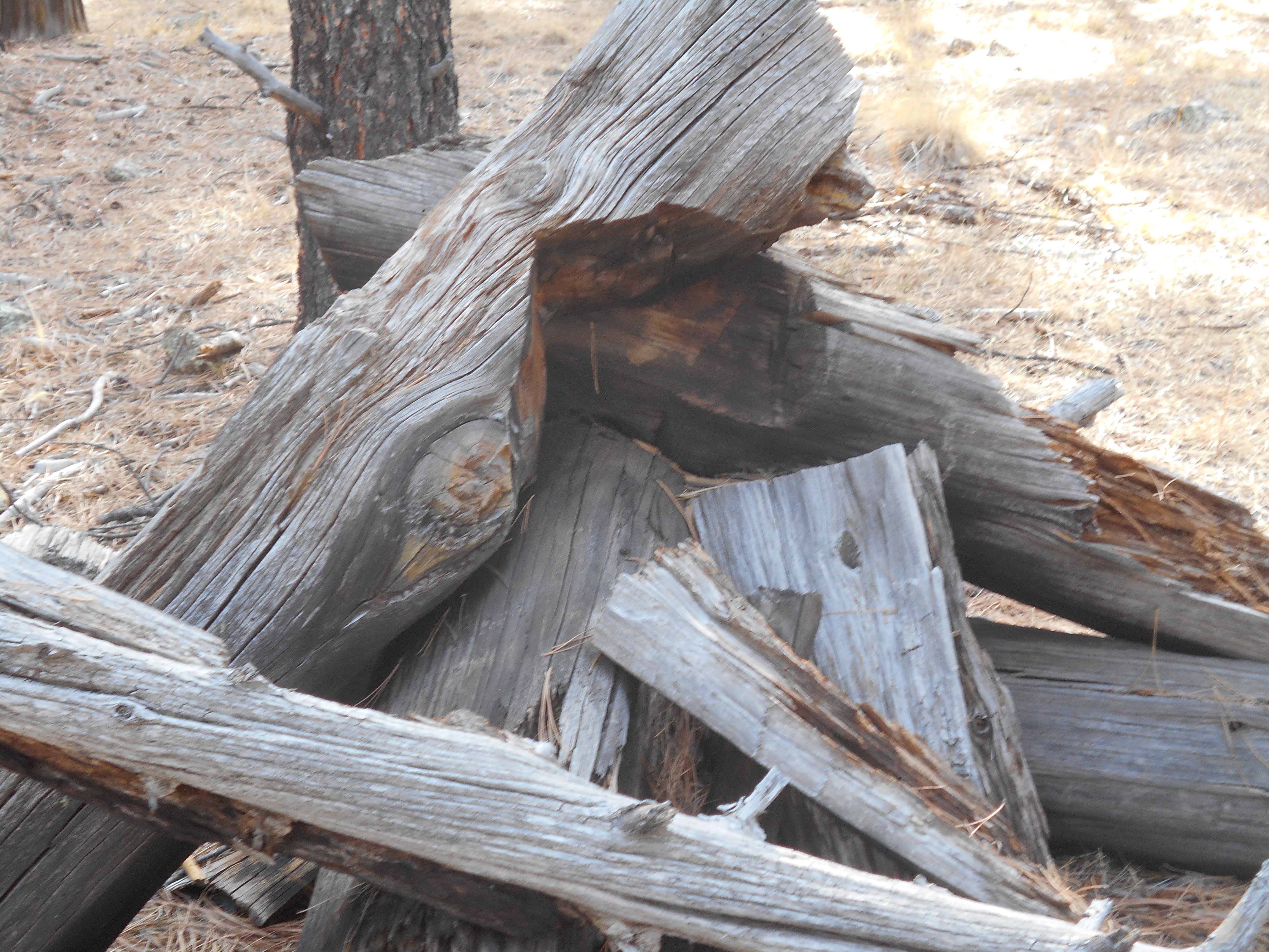
Cribbing, in the form of logs, support the roadbed
Just west of the grade, a spur appears to head north into a side canyon
West of the grade are artifacts, revealing that the line continued on to Rancho Viejo Tank. This section of metal appears to be the remains of a door runner on a box car.
Once the mother road was found, other remnants of the grade began to reveal themselves. East of the main location, the faint outline of the grade could be seen across an open park area.
This appears to be part of another section, where the grade exits the park area. My camera has a bad habit of mixing-up the pictures, making it an adventure just to post them in proper order. I felt my day was complete after finding two, separate, clearly identifiable sections of grade.
Through-out the canyon are remnants, strewn about the landscape. There are additional sections of grade in the area, not as easily seen.
After hiking a large portion of the canyon, several conclusions can be made. Although the terrain varies from open park-like meadows to narrow rugged passages, it posed no additional problems similarly found in other areas that the Saginaw traversed. The grade varies from level to moderate inclines, again nothing that a Shay locomotive could not handle. With the continual curves and grades, the branch line would require constant attention by the locomotive engineer. Then again, being a logging railroad, any engineer worth their mettle would be capable of handling this line.
One of the greatest challenges would be the ever-present threat of wash-outs. Arizona weather can vary from dry conditions to torrential monsoons. Having clambered over the rocks and debris, I could see by the evidence that the high-water mark can be three-to-four feet above the river bed. Even the open areas show signs that they can flood from one-to-two feet. This amount of flooding could cause devastation to the railroad's roadbed. Then again, the Saginaw employed crews capable of laying new, temporary track over the most primitive conditions. Other lines that were operated by the company were kept in working order, which added to their collective experience in battling and overcoming, albeit temporarily, the whims of nature. The remnants of the Rosilda Spring Canyon line have the appearance of being temporary in nature; adequate enough to provide a substantial structure to move the logs, simple enough to quickly repair, and relatively easy to remove once the job was completed. To avoid the tight confines of the narrows, where the water flow would be most severe, the line ran along the ridgeline, if and when adequate room was afforded. This contributed to the rolling, up and down nature of the grade.
Seasonal flooding could be the reason why no sign of a logging camp was found in the canyon. If such camps were in the area, they would be located on the spurs that most surely ran up into the various clefts and draws along the canyon. Evidence to this assumption can be drawn from the cabin like structure's location on a gentle grade exiting the canyon.
Two questions remain: why did the surveyor/engineer suggest this canyon as a mainline, bypassing the Santa Fe? Why did an early map show that two separate bridges, 450 feet and 100 feet in length, were proposed for the line?
It is entirely possible that the surveyor was aware that a logging line already existed in the canyon. With the addition of an extension, from Rancho Viejo Tank connecting with the original Saginaw Southern line (at the intersection of FR132 and Highway 73), the simple logging line would become a conduit for logging operations located in Garland Prairie, and the mill in Williams. A problem presented itself, in that the connection would cross homestead land, and no homesteader would be willing to yield to a noisy logging railroad crossing their serene and peaceful landscape. For this reason the Saginaw and Manistee began to reincorporate the Saginaw Southern Railroad, which would give them condemnation rights along the right of way. One could speculate that the surveyor was aware of and used this old logging line, thus saving himself a great deal of slogging through the forests and canyons south of Williams. In other words, he "fudged" the effort and difficulty in finding a new line.
If the proposed right of way was to be built to a higher standard, such as would be required by a Class 1 railroad, then the two proposed bridges would make sense. This would also mean that a significant investment would be made in upgrading the existing track work.
This puzzle me; my observations while hiking the canyon gave me the perception that with some minor upgrades and adjustments, the existing line would be adequate for their needs. Another grade, located in Big Spring Canyon, served a large area under similar conditions, yet without any major construction projects. My way of thinking leads me to the idea that the surveyor was overstating the complexity of the new grade, thus tilting the scales to his second proposal (once again made with great fanfare) to connect with the Santa Fe, North of Garland Prairie. The Santa Fe often exercised great influence in the region, in particular on a surveyor looking for work in this remote area of Arizona.


No comments:
Post a Comment