INTRODUCTION
(Updated 6/16/21: Revised 7/7/23)
COPYIGHT; ALL RIGHTS RESERVED (5/10/22)
The dawn of the twentieth century shone brightly over the Arizona Territory. Less than 120 years after the Declaration of Independence, the United States spread across the continent, from the Atlantic to the Pacific oceans. Within the broad context of world history, the United States was a young nation, and with such youth comes energy, resourcefulness and an unashamed brashness regarding the future. Opportunities abounded for growth and prosperity; one such opportunity was the vast Ponderosa Forest of the Arizona high country.
On February 14, 1893, the Saginaw Lumber Company of Saginaw, Michigan firmly planted its presence in Williams, Arizona. Coming from the forests of Michigan, the owners and operators of the Saginaw had hands-on experience with forest logging. For the next forty-eight years, through several company reorganizations and corporate entities, the Saginaw and Manistee was a major driving force in the regional economy.
It is time that Williams, Arizona and the Saginaw and Manistee Lumber Company are given their due place in the annals of Arizona History. This blog is focused on the town of Williams, Arizona; and the Saginaw and Manistee Lumber Company with its six related logging railroad lines into the woods in the Williams/ Flagstaff area. This will also include the mill located in Willliams. The various logging lines, such as the North Chalender, the Tusayan District, Garland Prairie and the Bellemont operations. All of these various parts played an important role in providing timber to feed the voracious appetite of the Williams Mill. The time frame of this blog covers the 1890s through 1942, when the corporation moved to Flagstaff, Arizona. The logging lines of Flagstaff, including the Saginaw after 1942, have been extensively documented by other publications.
Another goal is to reveal all of the remarkable recreational opportunities in the National Forests and State Lands adjacent to the town of Williams, Arizona. Wherever possible, a section on Recreation Opportunities will be included in each post. This will hopefully broaden your experience by visiting the lakes, scenic wonders, and other points of interest. Simply stated, get out and hike, but do so responsibly. For further information, please review the post on Hiking and Forest Etiquette.

An overview of Williams Arizona, circa 1930s. In the distance is the mill site.
Williams is located in the center, The Atchison, Topeka and Santa Fe
rail yard and servicing facilities is located near the bottom.
All Historic Photographs in this section, unless otherwise noted, are from the
Arizona Memory Project: Williams, Arizona Collection. A copy of the original scans
are available at the Williams Historic Photo Project, located in Williams, Arizona.
A VERY BRIEF HISTORY OF WILLIAMS ARIZONA: AS IT RELATES TO THE FOUNDING OF THE TOWN, AND THE SAGINAW LUMBER COMPANY
The earliest occupants of the northern area of Arizona were the Hopi, and Apache. The Spanish were the first Europeans to venture into this vast area, with hopes of golden cities. On one of his expeditions, the Grand Canyon was viewed by Garcia Lopez de Cardenas in 1540 (Roberts, 62.) Although awed by the vast beauty of the canyon, the Spanish were more pragmatic; they were after riches in gold and silver that could make a man rich, not the inspiration from such a scene that enrich the spirit and mind. The Nation of Mexico, once separated from the Spanish Crown, sent expeditions as far north as Utah.
Despite the early efforts, the high country of northern Arizona was little understood or appreciated by outsiders until the mid-1800s. It took the Mountain Men; those independent-minded trappers and wanderers of the uncharted western frontier, to venture forth and begin to understand the wilderness. These adventurers, as well as the original people who occupied and thus owned the area, had the mental capacity to map and identify key features, recall important locations, and navigate without written documents.
One such Mountain Man was old Bill Williams, who ventured into the area seeking wealth by trapping animals for the fur trade. An over-abundance of curiosity and a sense of bravado spurred him on to many adventures while exploring the area. He is well-remembered, having numerous landmarks and features bequeathed with his name. He and other Mountain Men provided invaluable knowledge for the first Anglo-American expeditions into the region.
The United States Government authorized the exploration of the western frontier by the U.S. Corps of Topographical Engineers. They were tasked with providing several practical railroad surveys, and establish wagon roads to California. In 1851, Captain Lorenzo Sitgreaves provided a reconnaissance of the San Francisco Mountains (North of current Flagstaff, AZ), and the area of Bill Williams Peak (South of Williams, AZ). The subsequent report was a "snap-shot," a quickly documented look of the region. This further expanded the written knowledge of the area, benefiting additional expeditions (Fuchs, 15: Goetzmann 244-246.)
Lieutenant Amiel Weeks Whipple assembled his expedition in July 1853 at Fort Smith, Arkansas. This expedition was tasked to explore and survey a railroad route along the 35th parallel, with special attention to the area between the Zuni villages and the Colorado River (Fuchs, 17; Goetzmann, 287-289.)
In 1857, Lieutenant Edward Fitzgerald Beale embarked on the survey and construction of the wagon road that would carry his name. Starting at Fort Smith, Arkansas, the survey and road traveled 1240 miles, to the Colorado River. One notable event was the use of camels to help transport their equipment. The road would become an artery allowing thousands of immigrants to travel to California, workers to the mines in Southern Arizona, and the movement of vast herds of sheep into the Williams area.
Passing north of Williams, the road generally followed one spring to the other, through the North Country. Years later, the North Chalender Line of the Saginaw and Manistee Railroad crossed its path in the Spring Valley area. By the time that the railroad grade was built in 1902, the Beale Road had fallen into disuse. It is easy to imagine that the loggers had grazed their horses where camels once trod and camped on the same ground where the early explorers had slept (Fuchs, 19.)
The Bill Williams Mountain area remained relatively untraveled until the 1870s. Those who did remarked on the lush grass and tall timber growing in abundance (Fuchs, 26,27.) The 85-mile Overland Road, stretching from early Flagstaff to the Fort Whipple-Prescott area passed to the south of the mountain. In use from 1863-1882, the road was originally used by the military. In the mid-1870s, large herds of sheep and cattle traversed the trail to the cool mountain meadows, to graze and fatten upon the abundant grass in the high country (Fuchs, 85.) This same road, by that time mostly abandoned, would later play an important role in the building of the Saginaw Southern Railroad.
Williams Historic Photo Project
The townsite of Williams, Arizona began as a post office (June 14, 1881) on the surveyed grade of the Atlantic and Pacific Railroad (the 35th parallel survey route.) The town also served as a construction camp for the building of the railroad (Stein, VI; Fuchs 32, 34.) Ranching and the construction of the A&P Railroad played a major role in the town's early history. The town was located on the ranch of C.T. Rogers, possibly one of the first settlers in the area, arriving in 1877.
With the building of the railroad from California, and the other half building west towards Flagstaff, the lumber and timber companies began to take an interest. The first mill sites, mostly portable operations, were established in 1882, producing volumes of ties for miles of rail bed construction.
Early Williams, circa 1890. Population 200
Several merchants established stores, either on speculation of future growth, or to service the existing construction camp and residents. Early photographs record a mixture of wooden structures, large tents and stone buildings, facing the expanding rail yard. Two stage lines served the region, including the up-and-coming town of Williams (Fuchs, 61.)
For a time, Williams was overshadowed by Simms- the construction camp and town located at the Johnson Canyon Tunnel site. Once the A&P had completed that project, the denizens of the town either followed the construction to Williams or drifted elsewhere.
The roadbed of the Atlantic and Pacific arrived in Williams in April 1882 (Fuchs, 56.) With the coming of the railroad came temporary freight and passenger facilities. A permanent station came in the 1900s; a freight station in August 1901 (Fuchs 116,196.) A railroad sponsored eating house was opened in 1883. Fred Harvey, a well-known provider of quality meals and service, established a welcomed presence circa 1887 (Fuchs, 98.)
With the railroad facilities, having a post office, the connecting stage lines, and a developing merchant's row, the town was developing the air of permanence. With permanence comes investment, with the hope of future prosperity. Civilization was advanced with the establishment of a school (1882). Church services were provided by circuit preachers starting in 1883. The population varied in the 1880s. The census of 1890 documented 199 persons residing in town- although this may not take into account the transient railroad laborers, saloon workers, or the outlying ranches and farms in the region (Fuchs, 58, 99,102.).
As with all frontier towns with hopes of becoming the next metropolis, wood and canvas construction brought the fear of fire. Williams would always face the imminent shortage of water, to fight the fires and to slack the thirst of a growing community. It became feast or famine; the feast of fires on dry wooden structures; the famine of water to quench the devouring beast. The report on one such fire in July 1884, reveals that Williams had several mercantile, a drug store, a hotel and restaurant, and the ever-present plethora of saloons. Due to the ever-growing demand for water, the railroad began drilling wells as early as 1886. A railroad sponsored dam was built 1887 (Fuchs 70, 79,82.)
Early High School, circa 1910. Building burned down.
It must have been a remarkable edifice of learning
The Cabinet Saloon, now an Italian Bistro. Just left of the picture is a house of ill-repute.
In the Background is the Grand Canyon Hotel. Circa 1890. All three buildings still stand
The main street, known as Old Trails Highway, circa 1917.
Later it would become Route 66
July fourth celebrations, 1909.
The A&P Railroad moved the division point to Peach Springs, AZ, causing a slump in prosperity from 1884-1886 (Peach Springs, still in existence to this day, was the source of clean water for many years for the railroad and the town of Williams.) In 1890, the town rebounded with the return of the division point. In 1901 a branch line was built to the Grand Canyon, spurring the expansion of the railroad maintenance facilities in Williams. Grazing, ranching, farming and the railroad were the underpinnings of the local economy, until the day that the lumber mill was built. (Fuchs 78, 81, 83.)
In April 1893, The Saginaw Lumber Company, of Saginaw, Michigan began building a large permanent mill, just west of the Williams township. A large number of company employees relocated from Saginaw, Michigan. On source indicated that a large number had already arrived, with another 23 families on the way. All of the related facilities to support the mill and the employees were prudently built on the mill property (see chapter on the Williams Mill; Fuchs 109,111.)
Like most growing townships, the leading citizens (modest in number) wanted Williams to become incorporated as a city. With incorporation came the official trappings of government: a town council; a city clerk and marshal; and the contentious issue of taxation. The first attempt at incorporation took place in October 1895. By December it was nullified in court. Some surmise that the burdens of taxes and licensing fees, and some degree of meddling by the lumber company, fomented the court action to nullify the charter (Fuchs, 125.)
As earlier noted, the Saginaw Lumber Company had shrewdly built all of their facilities, including employee housing, on company property. When the town was reincorporated in 1901, all of the mill property- and related facilities- were excluded from the city limits, thus eliminating city taxation (Fuchs, 128,129.) This was possibly one of the earliest examples in the Arizona Territory of tax breaks for corporate investments.
In December 1893 an experimental telephone line was strung from Flagstaff to Williams. In 1894 a permanent line was made between the Williams Depot and the main mill. In July of 1897, a connection was made between the offices of J.M. Dennis Lumber Company in Williams, and the Sawmill located 8 miles at Walker. A long-distance line to the outside world was completed in September 1901 (Fuchs, 145,179.)
The principal industries in the early 1900s were: the livestock industry (sheep and cattle grazing): the lumber industry; and the Santa Fe Railroad. The latter built the shops necessary for a division point, further expanding operations once the Grand Canyon branch was opened.
Mining had proved unprofitable; however, there was one rich lode of pay that was left virtually untapped: tourism. As early as 1902, new hotels, eating establishments and curios shops were developed. By 1930, in addition to the railroad's Harvey House and Fray Marcos Hotel, and the old but respectable Grand Canyon Hotel, "There were two auto camps...several mountain resorts west of town, four or five service stations, three garages...the Button and Cherokee Hotels" were open for business (Fuchs, 258.)
In 1929, the Great Depression began, eventually seeping into the daily lives of every citizen. Williams was not immune. The mill, at reduced production, continued to operate with occasional shutdowns (Fuchs 273.)
In 1933, a company commissary was established at the mill. The local newspaper was sharp and pointed in response. This became a contentious issue with the city (see Mill Chapter.)
In March 1941, the Saginaw and Manistee leased and then purchased the Arizona Lumber and Timber Company in Flagstaff, AZ. At the start of 1942, it was obvious that the company was leaving Williams. In June of 1942, all production was ended. In September of 1944, the city purchased the old mill site, and both dams of the Saginaw and Manistee. The new high school and housing developments now occupy the former mill site (Fuchs 263, 264.)
Williams continued on through the slow years, and the prosperous ones. Eventually the tourism industry, with the revitalization of the Grand Canyon Railway, brought stability. Today, with the promise of new recreational activities, the steady growth of the housing market, and the cult like following of old Route 66, hope endures that this once frontier town will remain for many years to come.
WILLIAMS, ARIZONA
A Blog regarding the history of the Saginaw and Manistee would not be complete without due consideration of Williams, Arizona. The two are intertwined, having co-existed and cooperated until the departure of the S&M in 1942. For such a small town, Williams has a fascinating history. As a startup townsite on the old Atlantic and Pacific Railroad, it has persisted through the ups and downs of the Atchison, Topeka and Santa Fe Railroad, old Route 66, and the Grand Canyon Railway. Like the resilient junipers and Ponderosa pines, the town once again thrives, refusing to give up. Someday a tall, stately monument will be erected; a symbol of the steadfast desire that this town is here to stay.
Williams is a living, fascinating look into that microcosm called the small town, replete with hardy and resilient citizens and denizens. All add their texture and color to the tapestry of daily life. This is where the City Council records the discussions on whether Third or Fourth street will be repaved this year, and how city water lines will be replaced. Seemingly insignificant to the large metropolis to the south, yet at the heart of it are citizens actively engaged with their representatives; call this democracy at its best.
The local paper discusses the new animal shelter, the problem of skunks in the downtown alleys, or how the senior center provides meals for the elderly.
It's a town that has one hardware store-Old Trails True Value. It has just about anything to keep the homestead in order.
You can find a local outfitter, who will help you with the best gear for your hunt, what fish are in each lake, and- if your respectful- you might get a hint where the elk are this week. You get to know all the owners, even call them by name.
It's a town where the locals are respectful and courteous; holding a door open or excuse themselves if they walk in front of you. Once they get to know you, they will do anything to look after you; pull you out of a ditch; or check on you to make sure you're not lost in the woods, or even just stop and have a good conversation about the weather. Neighborly; that's the word. A place of strong opinions, and even stronger and steadfast friendships. We call this a community; I thank God every day to call it home. This is Williams.
*************
RECREATIONAL OPPORTUNITIES IN WILLIAMS, ARIZONA
The original mill site is covered by the new high school, and housing tracts. The railroad line, heading south into the woods, can be seen across the lake formed by the Santa Fe dam. You can walk across the dam, and hike part of the old grade until it enters private land, where it is posted with No Trespassing signs. The lake is a nice place to explore, fish or have lunch. Check the posted signs as the fish may have mercury contamination.
Williams offers numerous opportunities. The old Route 66 passes through the downtown core, where you can casually shop or dine. Many of the old buildings still exist and can be visited and admired while you shop. The old railroad station is open and houses the offices of the Grand Canyon Railway. Shops, and a restaurant are on the premises. Check out the open-air displays of various railroad equipment, including a shay lettered for the Saginaw and Manistee Railroad. You can also make arrangements to ride the Railway to the Grand Canyon.
Three-truck, three cylinder Shay locomotive, located on the
station/ hotel grounds. Although lettered for the Saginaw, it never worked in the local woods. It is similar to those iron steeds
that did. There are three steam locomotives on display The Grand Canyon Railway Station. The restored station is worth taking the time to visit. A hotel, restaurant and
several gift shops are available. Don't forget to browse the
delicacies at the fudge shop.
Don't forget to visit the original freight house, that now houses the Visitor Center and Museum. The Center is a cooperative effort between the Chamber of Commerce, the National Forest Service and several other agencies. Good small-town cooperation at its best. The staff are very friendly and are more than gracious with their time. Here you can ask for additional information, maps of the downtown area and the national forests. Ask for the free Kaibab and Coconino National Forests Road maps. Be sure to seek directions to the remarkable areas pointed out in this blog. Don't forget to visit BEARIZONA, just east of town. A coaster and recreation park are now open on the east end of town. One day soon, the Northern Arizona Railroad Museum will open its doors, properly befitting a town with such a rich railroad history.
The Visitor Center, home to friendly people, good advice and a local history museum. Local history
Books are available to purchase. Ample parking is
available. Since your in the area, why not stop by?
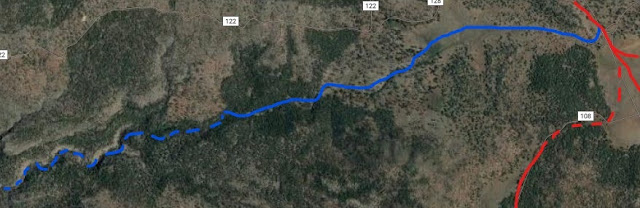
The Santa Fe Dam and lake. The Saginaw Southern Line
can be seen on the far side of the lake. Located on Highway 73, heading south of Williams
There are several Recreational Vehicle campgrounds near the downtown area. Hotels and motels in every price range are located along old Route 66 in town, or in the nearby community.
*****************
PREFACE AND INTRODUCTION:
THE SAGINAW AND MANISTEE LUMBER COMPANY, AND WILLIAMS, ARIZONA
The author does not assume to write a Blog that will compete with prior publications. This effort is to add to the understanding of what happened during the time of extensive logging by the S&M in the Kaibab, Tusayan and Coconino National forests. The author heavily relied upon the works of James R. Fuchs, Pat Stein, and Vernon Glover. Wherever possible, references have been provided with appropriate citations. It is not possible to construct any historical account of the Williams area without citing their previous works. This work is not intended to be a competitive recitation, but an attempt to add to the annals of history. It is hoped this that this will inspire further research and documentation of a fascinating part of local history.
There will be occasional points of historical interest that diverges from the main theme of this blog. The inter-weaving of lives and events are what makes writing about history so fascinating. Besides, the author found the information to be relevant, so here the story is told.
Specifics as to the goings-on in the past century can only be uncovered by the stolid persistence of a bookish researcher, or the hardships endured under the fierce southwestern sun by a pluckish and tanned adventurer at work in the forest. One can imagine the researcher seated within the confines of an archival library, casting a glance out the window; wondering what it would be like to lunch in the shade of a Ponderosa pine; snacking upon tin meats and crackers. The field or archival researcher are not mutually exclusive, but are best expressed by the individual capably pursuing both methodology. Therein begins the excitement of a modern amateur archaeologist, delving into the archives and then diligently pursuing the facts in the field.
The author has spent many an hour on the ground, pursuing the faintest of grades and eventually being rewarded with a new understanding and appreciation of those early loggers. Time spent in the archives is to be considered an investment in the pursuit of knowledge, not a sacrifice just to pass the tedium of daily life. Researching the archives at the Cline Library of Northern Arizona University is an ever-so-slow and methodical revelation of the story regarding this once remarkable and proud Company.
The joys of of field research comes with the burden of responsibility. Historical sites can be fascinating in content, yet fragile in existence. A casual disregard of artifacts can result in disaster for the long term understanding and survival of a protected area. Respectful behavior is a necessity to protect a site. Unfortunately, good behavior and forest manners are learned behavior, and not everyone wants to behave. There are regulations for the National Parks and Forests, Historic sites and Private Property. Destruction or disturbance of historical sites or features can result in severe fines and imprisonment. There are limitations on the use of metal detectors in the State of Arizona. If in doubt, contact the Forest Service office or the local regulatory agency
The author would not be a man of conscience if he had not struggled with the morality of revealing the hidden archaeological secrets of the forest. There must be a balance between the need for public access, and the need for preservation of historic areas. As a result, those areas that provide controlled public access, and are generally well-known are mentioned within the blog. The serious student of history will be left to find those sites that are best left anonymous, buried beneath the detritus of the forest and the dust of time. This is not an extensive survey of the historically significant sites, but a study of the various logging lines into the woods and selected publicly accessible locations. Having made this determination, the provided maps are a paraphrased rendition, not a total reproduction of all of the lines and spurs known to exist.
Time has slowly erased the efforts of man from the landscape. Soil has given way to rock, the ever-present marker that nature has placed upon the land. As an example, barely a trail was evident when some intrepid individuals decided to retrace the Beale road. This once important wagon road was again brought back to reality, born from a distant memory, to newfound status in the annals of Arizona History. As such it was worth mentioning within the pages of this book, since the path crossed the roadbeds of the Saginaw And Manistee. If the Beale road is worth giving honor, then certainly the memory of the S&M deserves preservation and respect.
Weather and climate conditions have a major effect on historical and archaeological artifacts. One hundred plus years of in-climate weather have taken a toll on the remnants of the past. Marshy ground grasps the thin outlines of the roadbed, slowly but persistently pulling it below its murky depths. Monsoon rains wash away any remains, as if to cleanse the land of the futile efforts of man. Flash floods wash away rock filled trestles, floating ties down the hillsides, and scattering artifacts with seemingly willful abandon. The ever-persistent threat of fire devours with no respect, whether the fuel would be forest detritus or valuable wooden artifacts. Much to the credit of the Forest Service, fire crews do what they can to protect sites from the eternal finality of flame. Many a site was bravely defended, as the etched-in-the-earth fire line marks where the battle was fought and won. In winter, snow blankets the land as if to give respite to the eternal struggle of man verses nature; peace prevailing albeit for a season.
Then there was the 1,000-year storm of July, 2018. A heavy-laden storm-front stalled upon the forests, south and east of Williams. A vast area was pummeled by heavy rains, significant in that within two hours 4.5 to 5.9 inches of rain poured upon the landscape. Unprecedented flooding occurred, turning meadows into lakes, streams into raging torrents. Once prominent historical features eroded away, or were washed clean of artifacts. Having witnessed such a storm, due caution will be given to the dangers of monsoons, thunderstorms, and flash floods. Take heed to the power of nature; respect is due, and the foolish should not trifle with such matters.
Time will eventually complete the task that nature has begun. Soon little will be left of the rutted wagon roads or trails trodden by those who have gone before. No adventure begins until you take the first step; no book is understood until you open the cover. Now that you have read these pages, continue the journey of discovery; Adventure is at hand.
The opinions expressed in this blog, unless otherwise credited to another source, are the authors.
REFERENCES/ BIBLIOGRAPHY
PUBLISHED BOOKS
Ferrell, Mallory Hope; "Nevada Central Sagebrush Narrow Gauge," 2010 Heinburger House Publishing Company, Forest Park, Illinois
Goetzmann, William H; Army Exploration of the West, 1803-1863; 1959, Yale University Press; University of Nebraska Press 1979
Richmond, Al; The Story of the Grand Canyon Railway, Revised Edition, 1995. Northland Graphics
Roberts, David; The Pueblo Revolt: The Secret Rebellion that Drove the Spaniards out of the Southwest; 2004, Simon and Schuster, Rockefeller Center, N.Y.
Schuppert, Thomas; Central Arizona Railroad and the Railroads of Arizona's Central Timber Region; 1993; Golden West Books, San Marino, CA.
Wahmann, Russel; Verde Valley Railroads, Second printing; August 1984, Starlight Publishing, Cottonwood, Arizona 86326
OTHER PUBLICATIONS AND DOCUMENTS
Arizona Lumber and Timber Company, 1887-1983; NAU Cline Library Special Collections NAU. MS.266 NAU PH676
Fuchs, James R. A History of Williams, Arizona 1876-1951; University of Arizona,1953. Internet PDF version available on-line.
Glover, Vernon J., A Brief History of the Logging Railroads of the Saginaw and Manistee Lumber Company, Kaibab and Coconino National Forests, Arizona (NAU Cline Library,Special Collections HE 3695.A62 G568. 1983)
Glover, Vernon J. Map Collections; and Archives Department, NAU Cline Library, Flagstaff, AZ. 1965 (Internet PDF available on-line.)
Brochure: Beale wagon road Historic Trail; USDA, RG-R3-07-5. 2013
Report on Proposed RR From Williams, MS 266 Series 3, Box 16 #140 1921:NAU Cline Library, Special Collections.
The LumberJack, Volume 1. December 1923 #8. A publication of the Safety and Welfare Committee, Saginaw and Manistee Lumber Co., Williams, AZ.
Stein, Pat; Logging Railroads of the Coconino and Kaibab National Forests; Supplemental Report to a National Register of Historic Places Multiple Property Documentation Form; SWCA Inc., Environmental Consultants, Flagstaff, AZ. SWCS Archeological Report Number 93-16; February, April 1993. On file with Coconino, Kaibab National Forests. PDF available on-line
Stein, Pat; Cultural Resources Management; Logging Railroads of the Coconino and Kaibab National Forests; Report Number 19, United States Department of Agriculture, Forest Service. July 2006
The Saginaw and Manistee Lumber Company, Map to Accompany Forest Industries Schedule, for year ending December 31, 1929: NAU Special Collections
Saginaw and Manistee Lumber Collection, 1893-1951; NAU Cline Library Special Collections NAU.MS.84
Saginaw and Manistee Lumber Collection: MS 314, Box 1; MS 84, Box 12 of 15, 16th Annual report-1936; December 25, 1932 Report; Box 12, folder 438; Box 15, Taxes and Insurance, Audit Report for September 1, 1929 to August 1, 1930 (C.E. Siddall); Folders 518,519.
S. Sales Kaibab (South End Unit) Map 7/30/35; NAU Map 522; NAU Special Collections.
Saginaw and Manistee Lumber Company, Forest Industries Schedule, Maps dated 1925, 1928 and 1929; NAU Special Collections
WEBSITES
ArizonaRailsRuinsTrails.Blogspot.com Arizona rails, ruins, and trails; December 2008-February 2018.
AZ.StateParks.com/Historic-Trails-of-Arizona; Overland Road
Arizona Memory project: Williams, Arizona Collection. Original scans available at the Williams Historic Photo Project, Williams, AZ. (AZMemory.AZlibrary.gov)
MUSEUMS
Collier Logging Museum, Collier Memorial State Park, Oregon. Oregonstateparks.org
Arizona Historical Society-Pioneer Museum, Flagstaff, Arizona. arizonahistoricalsociety.org
Somewhere in the vast forest, relics of the past await discovery. Cherish and respect those who have come
before us.


Comments
Post a Comment