Sunday, December 12, 2021

BELLEMONT LINE: BRANNIGAN TANK TO SEVEN ANCHOR TANK, FR9001N

 BELLEMONT LINE: BRANNIGAN TANK TO SEVEN ANCHOR TANK, FR9001N, 81B 

      The Brannigan Tank area was covered in the March 19, 2020 Post. FR9001N is the spur heading north to the Seven Anchor Tank area. This area is part of Government Prairie, a protected place left to nature. The location blooms during the spring, and in the good years, various wild flowers bring forth their majesty throughout the summer months. "Even Solomon was not clothed with such splendor."  It is also home to a variety of wildlife, such as elk and pronghorn antelope. Traveler beware: the roads across the Prairie can be very rough, and impassable during the monsoon season. 

    The following information may seem "preachy," nevertheless there are people who need to be reminded: please follow directions on posted signs. As stated in other posts, and continually repeated, do not destroy or desecrate historic sites. My posting regarding the Bellemont Line and Camp 2 area remains the same; digging things up and removing items from a historical site can result in stiff fines and imprisonment.  


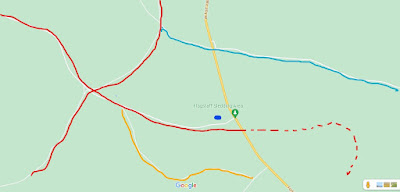
RED is the spur along FR9001N. The Dotted Red lines are spurs 
indicated on early forest maps. YELLOW arrow points to Brannigan Tank.
LIGHT BLUE arrow highlights Government Prairie. 
BLUE designates spur and loadout area. 

At Government Prairie, looking towards one of the Government Knolls.

A herd of Pronghorn Antelope. Even though thousands of miles away, yet they act just like the antelope of the African plains. Being a nature reserve, the area is rich in wildlife.  

Looking North across a portion of Government Prairie. 
Kendrick Peak is in the distance.


The area of study is accessible by following FR9001N from Brannigan Tank (very rough and rocky in places,) or by taking FR81B from Government Prairie.

FR9001N is either on, or parallels the original spur as it heads north.

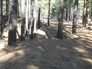
Grade and road as it ambles through the forest.


Remnants of the original roadbed, not covered by the forest road. Original construction techniques can be seen; logs were placed parallel to the line of travel, then covered by rocks and dirt to the desired level. Standard gauge trains traveled this line. 

A slight ramp, just to the side of the forest road. At the top of the ramp is a clearing, where the spur diverges from FR9001N  


Part of the clearing, where the spur cuts-off to the East. Thankfully, no one has used this log for their camp fire. Sometimes a downed log may look like a good candidate for a campfire, however it may also be a significant artifact of the early loggers. One-hundred-year-old ties were often consumed by fire, whether it was in a fire ring or in a forest fire. Whatever the case, they no longer mark the path of those early roadbeds, making it a challenge to document their route. Please think first before burning history. 


The spur as it heads Northeast from FR9001N and the clearing.


The spur near the top of the hill, looking back on the line. As you can see, the grade becomes difficult to follow, and you could risk losing sight of it. Be careful and don't get lost. If it looks like you are getting lost, stop, turn around and head back. 


The spur ends at the top of the hill, and there are no discernable features.

Near the clearing, just to the side of where the spur begins, appears to
 be another spur and loadout area

At the load out area, there appears to be a wagon road going up the ridge, probably 
created by the big wheel logging carts. 


Some of the detritus of early logging found along the forest road. FR9001N dead-ends into two other forest roads. One on the left will take you back to Government Prairie. The other one heads east, intersecting with several other roads, and eventually reaching FR171. 
Reference a good forest map for directions.

Saturday, December 11, 2021

North Challender Line: Spring Valley Area; Chasing Logging Unicorns

 North Challender Line: Spring Valley Area; Chasing logging Unicorns

    One of the pleasures of field research is visiting old sites and grades; doing a bit of puttering and hiking, and hopefully gaining some useful knowledge. Once in a while, I return to a place that reveals new evidence, yet does not allow for me to come to some definitive conclusions; it's like finding the prints of the fabled logging unicorn, yet destined never to capture a photograph of the mythical creature.   


    The hunt began in the area of Spring Valley, not far from Section Hill. FR141, Spring Valley Road, jogs around several parcels of private land, then heads further north to intersect with FR144. FR194, the area of interest, heads north from FR141, just before making a left-hand jog across the park. The Saginaw and Manistee North Challender line (RED) crosses this area. The line crosses private property, angles through another ranch, and then crosses FR141. An embankment can be seen just to the East of the road (further information on this area is contained in several previous posts.)
     It would be remiss of me not to mention that the Beale Survey and Wagon Road Expedition traveled through this area. Camels once trod this way. Further information is available on that post. 
    FR194 will take you through an area that is now being used as an unofficial off-road vehicle recreation area. The dirt embankment that carried the line up a hill has now been all-but obliterated. The difference from four years ago is striking- another location where signs of the roadbed will be no longer. Up on the hill or ledge, the road continues, and the railbed is on or parallels the road. A forest road, marked as FR726 or FR2463, is on the left. Both markings were along the route; Map indicates the road to follow as FR2463 (marked BLUE on above map.) This appears to be the original spur, not the main forest road FR194.


The road has all the appearance of a logging spur. Keep following the road to the right. There is another forest road on the left that takes you to a tank in a meadow. Road is probably closed and is very rough. That area is fenced, and the road map shows it as private property.  

You can see remnants of the early logging efforts, 
with numerous stumpages and fallen trees left to decay.   


At the far end of FR2463 (or one sign showed FR2462) where it reconnects with FR194, 
there appears to be remnants of this grade, or maybe another one, in the forest.  


    It is my opinion this spur continued on, heading north on FR194, then FR171, towards Pumpkin Center (RED dotted line.) Just to be clear; Pumpkin Center is largely private property. Don't trespass; people are very protective of their privacy. 
    There is also the possibility that a spur followed FR171, heading west from the Bellemont Line. Pumpkin Tank (designated in YELLOW), has the appearance of a grade nearby.  There are a number of tantalizing, additional clues along FR171, but nothing that I can say is for sure; tracks of my mythical unicorn. 
    I can also speculate that a spur, from the North Chalender Line, crossed the area from the West, and circled Moritz Ridge. Since most of this is on private property, I can only guess using old forest maps. There was just too much of the good timber in the area back then, to disqualify this theory.  
    The ORANGE arrows highlight a location where it appears my unicorn may have trod. As can be discerned from the following photographs, there appears to be a distinct grade paralleling the road.  


The grade appears to turn towards the ridgeline.

In this particular area, it is difficult to find the old stumpage associated with early logging. However, I did locate near the road several stumps that have all the earmarks of this time period. Further along the road, there is a gully, where more evidence such as this exists.   
Is this a logging grade, once lost, but once again found? 


Thursday, December 9, 2021

BELLEMONT LINE: VARIOUS SPURS NORTH OF BELLEMONT, ACCESSABLE FROM HIGHWAY 180


BELLEMONT LINE: VARIOUS SPURS NORTH OF BELLEMONT, ACCESSABLE FROM HIGHWAY 180

    Recently, due to the late arrival of Fall and Winter rains, I made a concerted effort to explore the far northern reaches of the Saginaw and Manistee's Bellemont Line. Most of the spurs mentioned in this posting are accessible from Highway 180. Be very careful slowing down or turning from this busy road. I suggest studying the information and confirming it with a quality road map. I use Flatline Maps, so some of the forest road numbers may differ. The roads and spur locations can be confusing, as the Saginaw and Manistee tracklayers were very "imaginative" in where they went through the forest.

    As a reminder, do not disturb or remove items from historical sites. 

    Kendrick Springs is one of the remotest areas traversed by the railroad.  I included it because I happened to pass by while traveling along FR90.

FR90 KENDRICK SPRINGS


RED designates Saginaw lines in the area. YELLOW designates FR90. 
DARK BLUE designates Kendrick Springs. LIGHT BLUE designates Cabin Flat Hill area.

I accessed the area by FR90, heading East from FR144. This route passes to the North of Kendrick Mountain Wilderness. The road can be extremely rough (note the rocks in the photograph), so a 4x4 is a must. It is also advisable to let a loved one know (do you really want to tell your worst enemy?)  where you are, in case something happens. It is remote and isolated, so due caution should be observed. At one time it appears that the Forest Service had big plans for this route, as a substantial investment was made on the road. Today, sadly, the road needs updating and truckloads of fill work.


Kendrick Tank, in greener times. 

There are a number of concrete structures or foundations in the area. 
This is an important watering hole for wildlife and cattle-grazing. Note the tree trunks have a noticeable burnt appearance. There has been a number of fires that have passed through this area, including one after this picture was taken. 


Looking North; The roadbed passes by an embankment by the road, and the water tank on the left. The "trickle tank" roof (hence the nickname "trick tank") has been added since the last visit.

Remnants of the spur can be seen along FR90, until the point, where the 
road angles off to the west, the spur continuing to the north.


Artifacts along the roadbed. Object is a brake shoe, either off an engine or the drum of a loader. 
Leave objects where you find them. Do not disturb or remove items from historical sites. 


*************
The next area, covered on the following map, is generally located north of Fort Valley, and northeast of Wing Mountain

RED designates S&M spurs in the area. YELLOW is Highway 180. 
PURPLE designates FR9008N Grand Canyon Tank spur. 
BLUE designates FR9004N AND FR164C spur
GREY designates FR222B and FR9230R spur
Dotted lines indicate areas of potential spurs, 
or areas not traveled in the forest. 
(Map courtesy of Google Maps)

FR9008N GRAND CANYON TANK
(DENOTED AS PURPLE LINE ON MAP)
The Grand Canyon Tank and spur can be accessed from FR222B, then turning onto FR9004N.
 Further up the road, another forest road, FR9008N (?), turns to the right. Follow it east to the tank.
 BEWARE: roads in this area are extremely rough and may be washed out. If it looks too dangerous, then don't drive it. Get out and walk; after all, that is what this is all about. Get outside and get some exercise, and always be careful. 

The spur follows the road on the right-hand side. A noticeable ramp takes the spur up a ridgeline, just before the tank. It then heads in the direction of Highway 180. This is looking down the ramp towards the forest road.


looking in the general direction of Highway 180. This section is not drivable. 
The spur, as indicated on the map, crosses the highway, then ambles through the forest, until it connects with FR151-Hart Prairie Road. Forest Service maps indicate the spur follows FR151 North for some distance. The road appears to be on the old roadbed.

 FR9004N AND FR164C SPUR
 (BLUE IN ABOVE MAP)
FR9004N is an old spur, and the road is on the old grade. It ambles through the forest, until connecting with FR164C. It is possible that FR164C is also a spur to the west of the intersection with FR9004N (there are indicators along the road.) The highway is a short distance away to the East. Forest Service maps indicate that the spur crossed the highway, continuing on or near FR151A until it connects with FR151, Hart Prairie Road.


FR222B AND FR9230R SPUR
(DENOTED IN GREY ON ABOVE MAP)
This spur is accessible from FR222B, on the South side of the road. The North side is another forest road that you may think leads to Grand Canyon Tank. It will lead to a steep gully. This road may be closed to vehicle traffic, so you may have to hike in. This spur is one of those serendipitous events, where hiking down FR9230R I found a spur that crosses the road. 


Following the grade east on foot will reveal that it parallels, at some distance, FR9002N, which is a pipeline road. This does not appear to be closed to vehicles. The spur eventually goes to ground (disappears) before reaching Highway 180. Don't get lost.


***************
The following map covers an area located midway between Fort Valley and Kendrick Park. The Snow Park recreation area is located nearby.


 The FR9009K Spur is designated in YELLOW. RED designates other spurs in the area. BLUE spot is Aspen or Water Haul Tank. FR794 Hart Prairie spur is denoted in LIGHT BLUE. 

 FR9009K at FR249 SPUR

FR249 is in itself a spur of the Saginaw (marked as RED on the above map.) This forest road passes by Aspen or Water Haul Tank (depending on what map your using: BLUE marks the tank on the above map.) As you approach Highway 180 going eastbound, you can see the original roadbed amble of to the right. The Dotted Red Line indicates where the spur continues East of Highway 180. This area is rugged and not well-marked, and as such is not recommended for travel. 

If you are driving eastbound on FR249, FR9009K will be on the right.
FR9009K is well-marked, and either follows or travels on the original roadbed.

The spur continues through the forest, until connecting with FR247. 
The road can be rough and rocky.

FR794 HART PRAIRIE SPUR
Although no pictures are available, there is a spur that generally follows FR794 to Hart Prairie (LIGHT BLUE on map.) If I remember correctly, part of the road passes through gated private property. It may be closed; if it is open, stay on the road.


Update to ATSF Postings

 I posted a six-part series on the ATSF in Williams, Arizona. Posting to a Blog can get a little wonky, and as such they are not in order. P...