Sunday, December 15, 2024

SAGINAW SOUTHERN PART II: LOGGING OPERATIONS AT THE END OF THE LINE

 SAGINAW SOUTHERN PART II; LOGGING OPERATIONS AT THE END OF THE LINE

The Saginaw Southern laid rails in 1898, and very quickly reached into this region. So quick in fact that the survey proved challenging and was placed in the most difficult of terrain. Part of the route, as documented in earlier posts on the Saginaw Southern, used the old military road from Flagstaff to Prescott. 

I decided to have a look-see to the west of Perkinsville Road, possibly uncovering additional traces of the rail line. 

Map courtesy Google Maps. 

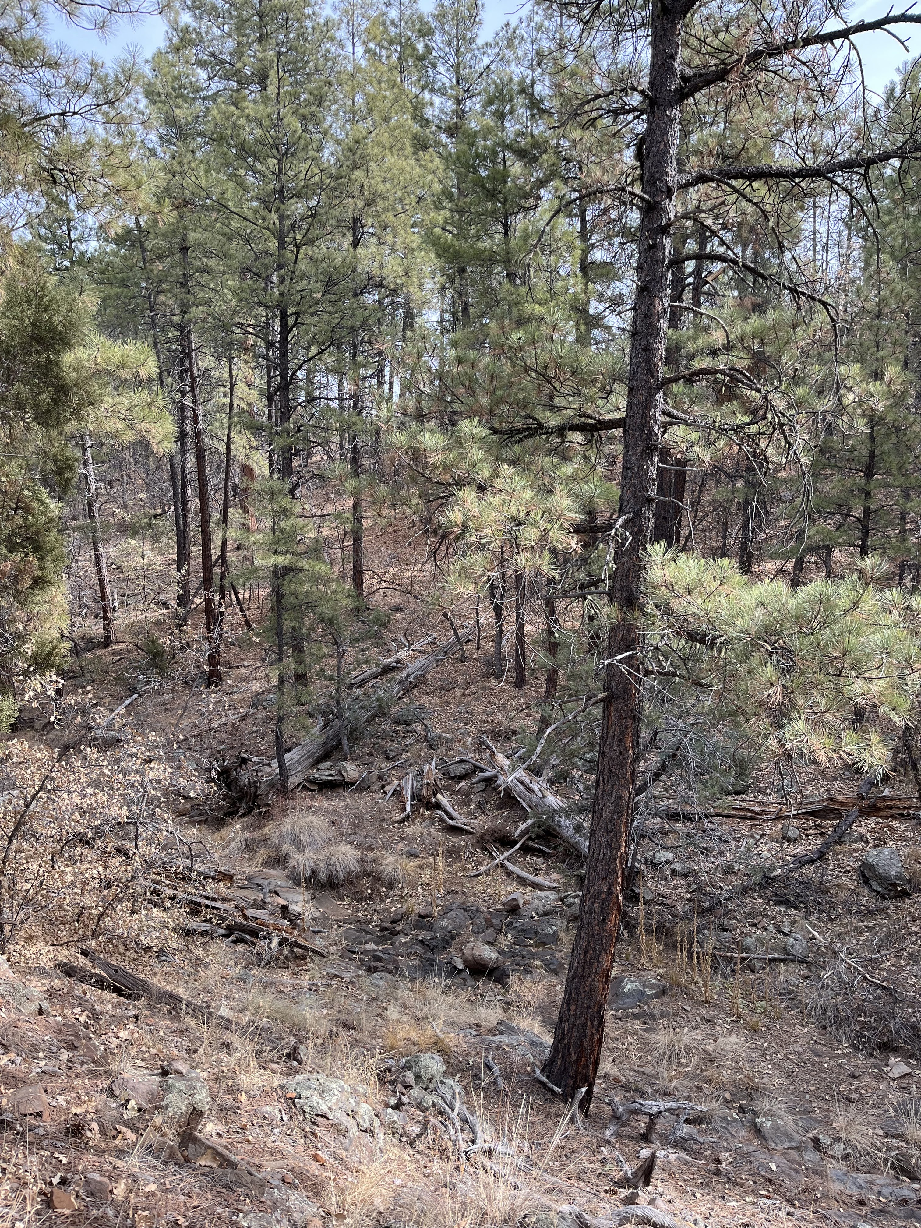
One day, I decided to hike into the area referenced on the map marked 35.094270, -112200100. I parked in a safe area off of Perkinsville road and began my journey. I carefully walked down into the ravine. Often the gentlest slope can result in a tumble, as it is assumed to be safe. Care should always be taken when hiking in the forest. As can be seen in the following images, there were a number of stumps and logs lying about the forest floor. I noticed that a number of them indicated harvesting techniques used during the time of the Saginaw. 

What was also evident were traces of two paths, widening in areas to the size of a road, one on each side of the ravine. Longtime natural erosion and decay would explain why they were at times just the size of a path. It was also apparent that they continued to the north and south, indicating a man-made feature that had a form and function. At this time, I could only speculate that these were used by Big Wheel logging carts to harvest the timber. 

I included a number of images without commentary. They should speak as to the nature of the area. Although difficult to see, there were the remains of two trails or roads. 


I am relatively tall individual; this should give you an idea of the height of this stump, about four feet in height.


Exploration continues in Parts III, IV.


SAGINAW SOUTHERN PART III: WAGON ROAD


 SAGINAW SOUTHERN PART III: WAGON ROAD 


Compliments of Google Maps

I returned for another visit to the areas covered in Parts I and II. After several visits, it was becoming obvious that the road feature continued on a northerly direction. In order to further define its route, and to find where it exits the canyon system, I decided to access the ravine from the Trap Tank area. The road is very rough for a short distance, then smooths out until it dead ends at the tank. 


The following three images are taken just to the south of the tank, at the slight finger of a ravine that shows up on the map. I documented this to show that the ravine is too steep for railroad access to the lower canyon system. It is also very picturesque, which is common in this part of the country. 
Reference 35.09840, -112.193610


Looking back towards the tank. I headed West from the tank, following a well-traveled game trail.


Looking over the rim towards the bottom of the ravine. The slope is gentle, and there is ample sign of deer and elk in the area. Reference 35.100600, -112.195630.


Closer to the bottom, downed trees cut in the manner of the time of the Saginaw become evident. Caution had to be maintained as to not come to any conclusions, since there is also sign of latter logging. The ravine runs in a north-south direction, and the map indicates that it connects with the areas described in Parts I and II. On the map, I connected the road between the two points that were investigated. This was conjecture; however it was based on the solid evidence that I observed.


On the west side of the ravine, I could see the slight trace of either a path, or a road. The Saginaw was in this area circa 1898, so any evidence would be aged and weathered by nature. A road, cut into the canyon's relatively soft and varied soil, would be eroded. Soil slumping, where the natural tendency of the soil is to slump or erode down a slope, would eventually erase a road. Whether it was a path established at a later date, or a simple road carved by horsedrawn scrapers, it was obvious that a man-made feature was to be found along the slope. 
Although not as clear in the image, the feature was obviously a road, and as it continued to the north, beginning an incline up the side of the ravine. This road continued to the south, possibly or more likely connecting with the road mentioned in parts I and II.  


The road continued at an estimated 3 % incline, providing a very steady slope.


 At several points, there were connecting roads to the floor of the ravine. Along the slope of the ravine, the geological features changed from one type of conglomerate to a more shale-like rock, even at times. Sandstone. These formed large to smaller sized slabs, similar to what the native cultures would use in building stone structures. No evidence of native culture was found.
                                                

Reference 35.103220, - 112.195010
At the top of the road's incline. This particular rock may have been place here to discourage vehicle travel down the road. Although not pictured, at the top the road continued on an old forest road, although most of the features had since eroded. 
One question needs to be asked; who made this road? It is obvious that it was made to access the ravine, and the purpose was evident in the numerous cut timber and stumps. It was also obvious that the area had been logged several times, and some indications (as in the following image) that some of the trees were harvested for firewood (the Saginaw had no reason to cut junipers.) 
A more modern road building effort, even using the most basic machinery, would have left a more defined profile with mounds of bulldozed dirt, and a rutted surface from trucks. The profile would not be as accurate as a gradual slope, instead the ruts and valleys would be the norm, along with the atypical rutting. 
Instead, the road surface is relatively smooth, with little indications of heavy machinery. At the time of the Saginaw, the normal way to create a road would be by horse-drawn scraper. The care taken to provide a steady slope, and an even surface indicates that this was meant to be used by either wagons or high-wheel, big-wheel, logging carts. Given the conditions of the soil, it would have been relatively easy to make this road by more simpler devices such as the scraper or shovel. 
The road has the appearance of aging, such as the aforementioned erosion. It is obvious to the observer that at some point it was used as a forest access road, then blocked and left for the ages. It would make sense that the Forest Service would have used this abandoned grade as a road, until such time it was no longer needed. 
I believe that there is ample evidence to say that this wagon road was the entrance to this part of the complex ravines that scar this vast area. It also appears to be connected to the other locations that I visited in parts I and II. 


Various logs and cut timber in situ. The methodology is similar to Saginaw practices; cut down a tree, then determine its value for hauling. The fellers were probably paid for the number of trees they fell in a given day. The limbers would then cut the branches or leave it, depending on the discretion of the foreman. And so, on went the chain of production. it is not uncommon to find perfectly good trees on the ground that were left behind. Their reasoning is left beyond the curtain of time. 
There are also other logs and stumps left by later logging crews. Another mystery as to why such things took place. It has been over 130 years since the last big wheel cart passed this way. I only search for the Saginaw...
Part IV will put the pieces together, and the answers will surprise you...


SAGINAW SOUTHERN PART IV: SOLVING THE MYSTERY OF THE WAGON ROAD

 SAGINAW SOUTHERN PART IV: SOLVING THE MYSTERY OF THE WAGON ROAD

In Part III, I left you to ponder the mysteries of the wagon road that was found in the remote ravines and canyons south of Williams, Arizona.  
I returned again to this region, hoping to find additional answers, and to confirm my coordinates. I ended up removing some locations and adjusting some of my ideas. It is frustrating to try and find additional information by field research, when you are trying to gather the facts after the passage of 130 years. 
I traveled FR44 once again, revisiting several sites. I did stop at Sheep Tank, which at the time I thought not worthy of using digital film to record. The tank was of simple construction, with one part of the stream bed entering the structure. A very basic site, using the natural flow to refill the tank. Most tanks have been enlarged and widened to almost lake-sized water basins by the Forest Service. This one seemed to have been left in its original condition, abandoned for what seemed to be an unknown reason.


Map Courtesy Google Maps

As I left the region, I felt frustrated. A great deal of time and effort to find an old road. However, history isn't about one specific event, but a series of events that can often seem unrelated, and then converge at a point to become part of each timeline. Sheep Tank: what does this draw to mind? An old military road, where did it traverse the landscape? 
It started to make sense. I consulted Google Maps and could see at the northern point a faint trace connecting to the road leading to Davenport Tank. The canyon and ravine system to the south pointed to, and apparently emptied into, the area of Sheep Tank. The pieces, at least in my mind, now fit together. 

Map Courtesy of Google Maps
Yellow with dotted lines is a projected route; solid yellow is actual road; double yellow is as seen on satellite image. Blue is Perkinsville Road. Happy sheep is Sheep Tank. Red is estimated end of Saginaw Southern.

What I conjecture is that I found a section of the old military road. 

This road was later used by the migration of tens of thousands of sheep from the lowlands during summer, to the cooler elevations of the High Country. In a northerly direction, Sheep Tank led to the area of Buzzard Tank, then up to the vicinity of Trap Tank. From there, the road led to Davenport Tank and Stewart Spring, and then the steep grade until reaching Summit Tank. From there it was an easy path to the green grasses of the Ponderosa Forest lands. There were additional tanks along the way that remained unnamed. 
The military road was used for many years, and its location was not unknown to the railroad surveyors. This region was harvested by logging carts, with little or no indication of railroad spurs. The old road would have been used to bring logs to the railhead. 
This is my theory; maybe my conclusions need further validating. You should not dismiss my conclusions solely because I am an amateur historian and researcher. After all, some of the greatest findings in history were based on amateur research...
Stay safe in the forest

THE WONDERS OF NATURE HAVE A PROCLIVITY TO PUNISH THE VANE ACTIONS OF MAN

Friday, December 13, 2024

SAGINAW SOUTHERN: NEW RESEARCH ON THE END OF THE LINE.

             SAGINAW SOUTHERN: NEW RESEARCH ON THE END OF THE LINE. 

The Saginaw Southern was an important part of the early history of the Saginaw and Manistee Lumber Company's vast empire. In comparison to other railroad operations in other areas of the country, the Saginaw was limited in scope, at best. However, when understood in the context of the history of development in the high country of Arizona, the Saginaw is second to none. 

The history of the Saginaw Southern is covered in the post, dated 6/15/21. One of the mysteries that continues, for this intrepid amateur historian, is: where exactly did this particular railroad end? We know that the initial planning was to reach the Jerome area, however they found one of the most difficult routes to lay rail, particularly for and entity that was incorporated as a class I railroad. My conclusion has been that they got caught up in the general railroad fever that gripped the nation, and rather hurriedly found a path south hoping to reach Jerome (possibly Prescott) before the Santa Fe. The fever only broke when the Santa Fe beat them to the Verde River. Once this was concluded, the Saginaw reverted to its original purpose of railroad hauling of the Ponderosa pine logs. 

I have visited, then revisited the area south of Williams to do field research, hoping to find answers. As of recent, I have found more evidence of their extensive operations in this region. The pine forests did end most abruptly, yet there were still big trees to be found in the numerous canyons and ravines that pointed like the fingers of a hand towards the southern regions of the Mogollon Rim. 


Map Courtesy Google Maps

Research area references of this post are 35.094108, 112.-191364 and 35.095550.112, -189770. Yellow designates a wagon road, red railroad line.

Other reference points will be covered in the Saginaw and Southern parts I-III.


A very large cut log that has disintegrated with time


A cut log, appropriate for the length of a Saginaw log, partially buried in the ground. 


A water bottle is shown for scale.


I walked up the ravine as far as possible, eventually stopping at a forest fence. Not in a particular mood to find a way over a barbed wire fence, I decided to return to the comfort of the car. The hike gave me the impression that this was not a box canyon, where access is minimized. Instead, the area could easily have been accessed from several directions. What is certain is that there would have been no way that the railroad could have progressed this way further south, due to the fact that a very rocky end was clearly in view. 


The end of the line, or is it?

It is quite obvious that this area was logged several times. Ample evidence as seen in the images suggests, nay verily verifies, that the Saginaw was here first. The type of logs and stumps indicates logging methods employed during the time period of the Saginaw Southern (1898.) 

Having revisited this site after many years, gaining experience and additional knowledge, I now look at this as an area having been logged by horse drawn big wheel logging carts, and is not the exact location for the end of the railroad line.

I have a theory that at the end of the line, which exists somewhere north of this location, the Big Wheel logging wagons or carts were used. This was not limited to just this site, but over a large area. Logs would be hauled to the railhead, then moved to the mill. The timeframe that they logged was very limited, as higher value timber tracts that were more readily available lay further north along the line. It would also be more profitable to log out the surrounding area as quickly as possible before heavy rains made the already difficult placement of the line more tenuous than before. A quick and intense logging effort would make the line more profitable, helping to recoup the costs of building with such haste on a marginal route. 

I would further suggest this broad area was cleared within a year, then the line was pulled up to be used elsewhere. One indication of their haste were the remnants of the more worthless logs, and at times spilling and leaving quality logs on the ground. 

More visits, more field research... Stay tuned for parts I-IV.

Update to ATSF Postings

 I posted a six-part series on the ATSF in Williams, Arizona. Posting to a Blog can get a little wonky, and as such they are not in order. P...