SAGINAW SOUTHERN PART II; LOGGING OPERATIONS AT THE END OF THE LINE
The Saginaw Southern laid rails in 1898, and very quickly reached into this region. So quick in fact that the survey proved challenging and was placed in the most difficult of terrain. Part of the route, as documented in earlier posts on the Saginaw Southern, used the old military road from Flagstaff to Prescott.
I decided to have a look-see to the west of Perkinsville Road, possibly uncovering additional traces of the rail line.
Map courtesy Google Maps.
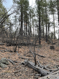
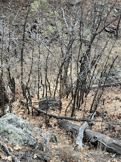
One day, I decided to hike into the area referenced on the map marked 35.094270, -112200100. I parked in a safe area off of Perkinsville road and began my journey. I carefully walked down into the ravine. Often the gentlest slope can result in a tumble, as it is assumed to be safe. Care should always be taken when hiking in the forest. As can be seen in the following images, there were a number of stumps and logs lying about the forest floor. I noticed that a number of them indicated harvesting techniques used during the time of the Saginaw.
What was also evident were traces of two paths, widening in areas to the size of a road, one on each side of the ravine. Longtime natural erosion and decay would explain why they were at times just the size of a path. It was also apparent that they continued to the north and south, indicating a man-made feature that had a form and function. At this time, I could only speculate that these were used by Big Wheel logging carts to harvest the timber.
I included a number of images without commentary. They should speak as to the nature of the area. Although difficult to see, there were the remains of two trails or roads.


No comments:
Post a Comment