THE BELLEMONT LINE 1903-1926(7)
Updated 11/21
COPYRIGHT; ALL RIGHTS RESERVED (5/10/22)

Red designates the Bellemont Line. Blue indicates the North Chalender Line.
Both are for general reference only
In 1903, a new line began construction from Bellemont, Arizona (West of Flagstaff, AZ.) heading north into the virgin timberlands. The line's operations were overseen by Logging Superintendent Charles A. Lindstrom. The Bellemont Line would become the longest running operation of the S&M. By mid-year of 1909 the line reached Brannigan Park; Fern Mountain in 1913; Kendrick Park 1917; Howard Seep 1920; and Deadman Wash in 1922. Deadman Wash was the farthest northeast the line reached. Extensive holdings were being logged in the 1920s near Wing Mountain, Fort Valley (East of Bellemont), and Kendrick Mountain directly north of Bellemont. There is evidence that the northwestern spurs connected with the old North Chalender line (see North Chalender post.)
Beginning in 1922, as the northern stands were depleted, the operation began to consolidate and harvest the Fort Valley/Wing Mountain area (Stein,35.) The harvesting of trees were to be in compliance with the Forest policies of 1910.
Steady, methodical harvesting continued, feeding the Williams mill. Trainloads of log cars were shuttled from Bellemont to the Williams mill, via the Santa Fe Railroad. When needed, the shipment of fuel oil, camp supplies and feed for the horses would be shipped from Williams to the Line, and the logging road would then disperse the supplies to the logging camps. During this time, freight rates charged by the Santa Fe were always a concern for maintaining profitability (Glover 3; 1983). Nevertheless, regardless of their occasional differences, the S&M maintained a long relationship with the Santa Fe.
The S&M had a limited amount of rails, and the purchase or lease of used rail would cut into profits. Removing old spurs, and relaying in new areas was the norm. A company audit of 1926 showed that the S&M owned 29 1/2miles of rail, and 20 track switches (Glover 3,4;1983.) Track and grading crews were kept busy keeping ahead of the logging operations.
As evidenced by those that occasionally can be found along the abandoned roadbed, ties would be recycle over and again until spikes would no longer hold. Then they would plug the spike holes, and keep on using them until completely spent. Mill seconds were commonly used for the logging lines; they had their own mill, so the free supply could be limitless. Farmers and ranchers found the abandoned ties useful in building fences. Several buildings using ties for walls dot the landscape.
Three used but serviceable (by logging standards) steam engines were leased to help with the production; two 4-4-0s and one 2-8-0 (Stein, 50.) Two new Baldwin rod-type locomotives were also purchased (these were the two purchased in 1904, 1907; Glover 3;1983.) In 1923 It was reported in The LUMBERJACK, the Newsletter published by the Safety and Welfare Committee of the Saginaw and Manistee Lumber Company, that two rod engines, one fifty ton Shay, and one thirty five ton Climax were at work (Volume 1, December 1923, #8. pages 1,6,8)
In addition to the steam engines, the line had approximately 100 log cars in service, loaded by two American loaders. At Bellemont, a 30,000 gallon oil tank was built to service the the engines. Interestingly, three water tank cars hauled all the water from Bellemont headquarters to the camps (THE LUMBERJACK; Vol.1, #8 page 7.) This would indicate that the S&M had found a local source for fresh water. Today, there are indications of functioning wells just north of Interstate 40, near the remains of a mill site ( Edward Ayers company.) At Bellemont, in the industrial park just south of the Interstate, can be seen an old tank and other structures, possibly the oil tank mentioned in the article. It is also worth noting that by this time the S&M had their own water cars, avoiding the need to lease them from the Santa Fe (see North Chalender posting.)
As technology was developed, the company phased-in new innovations. Under the guidance of General Manager Mr. E. J. Wilder, portable camps became standard, replacing the worn-out outfit cars made from old boxcars. Camps were probably a mix of new and old as portable cabins were phased in. The cabins were built to a size that would easily fit on the log cars, being lifted by the steam-powered loaders of the time. A new camp numbering system was implemented, and as camps were relocated they kept the assigned number, where ever on the line they moved.
Specialized camps were developed, separating logging camps to the far flung spurs, and leaving camps like Camps 1and 2 on the Bellemont to focus on track construction and engine maintenance (Stein 35.) Like camps 1 and 2, headquarter camps had a more permanent nature, with engine sheds, and maintenance buildings (The Garland Prairie headquarters camp had underground piped water.)
Camp #1 was the construction crew camp. This would normally include the track construction foreman, cook, flunky (cook's assistant), foreman's assistant, head cook, workers/ laborers, teamster(s), plowman, and a powderman (Saginaw and Manistee 1917a.: Stein, Report #19, pages 224, 225.)
Camp 2 was the "railroad operation crew", consisting of: the train crews (engineer, brakeman, fireman), night watchman (who also kept the steam up in the engines), loader operators (engineer, top loader, hooker-loader), cook, cook's helper, section foreman, section men, and engine service men (hostler, mechanics.) In 1917, the camp had 11 occupants. Wages ranged from $130 per month plus room and board for engineers, to a low of $40 per month plus room and board, for section men. By 1921, salaries increased to $150 per month plus room and board for engineers, with the top pay earned by the foreman of the train crew, $210 per month plus room and board (Stein, Report #19, pages 224, 225.) It is assumed that the housing was provided at the camp's location.
By 1925 the camp had expanded to 32 employees: 4 engineers, 5 firemen, 2 master mechanics, 2 night watchmen,1 brakeman, 3 car repairmen, 1 loader, 1 section foreman, and 13 section workers. Note that the section foreman and 13 section workers, and one master mechanic had Hispanic surnames. Other camp members had English and Scandinavian surnames (note the photograph in the Williams Mill post, showing men from every walk of life-a diverse group- at the mill.) Circa 1925, Camp 2 was relocated to the Garland Prairie line. (Stein, Report #19, pages 224, 225.) Operations on the Bellemont line soon wound down, although there are some historical indications that the line was operating, albeit at a much-reduced size, until 1929.
The logging camps, such as Camp 20 were located some 12 miles northeast from Bellemont, and camp 21 was near Fort Valley (LUMBERJACK, page 1.) According to the LUMBERJACK (Volume 1, #8, December 1923, pages 6,7) Camps 21 and 22 were the most up to date:
"...This consists of men shacks, substantially built, with ample comfortable accommodation for two men and horse barns with capacity enough to stable two horses. These shacks and barns are portable so that when camp is struck, they are picked up by the loaders, placed on log cars and moved to the next location...in one day. The blacksmith shops are made on the same plan but in two sections and the hay roofs are also portable...the railroad construction camp is entirely on wheels and therefore is also ready to move at a moment's notice..." (Italics mine.)
It is interesting to note that the construction camp is "entirely on wheels." This would indicate that a separate train for building spurs was kept on rail cars. As such, they could be sent to the area where a spur was to be taken up or built and was an entirely self-contained operation. This might be the reason that the construction camp's location (#1) remains a mystery. It might just be that they were on a siding, when not otherwise preoccupied, somewhere in the vicinity of the steam engine facilities. (An inventory of the Camp #1 at Tusayan is listed in the Tusayan post. Since the S&M transferred camps from one location to another with the same number, this could very well represent what the camp looked like at Bellemont.)

A track laying gang, somewhere in the Coconino National Forest, circa 1914. Interpreting a historical photograph can be an interesting past time. The grade is simply formed and scraped from the forest floor. No ballest is used. Once the ties and rails were laid, a rail-born cart was used to bring additional supplies to the crew. Two crew sections are at work: one laying track past the switch, and the other adjusting the mechanism. One of the workers has become the self-appointed foreman, having declared a break for himself and is idly sitting on the rail. Others stand about, lending a hand when asked or needed. Then there are the few who actually are actively participating in the endeavor. Finding and retaining good workers was always a challenge. The detritus of construction is strewn about to the side of the tracks. The track is standard gauge; the lens of the camera distorts the perspective. Courtesy of USDA Forest Service, Coconino National Forest
The article continues to note that "...At each logging camp are a commissary car, kitchen car, two dining cars and a supply car, fifty men shacks, twenty horse barns and a blacksmith shop (page 7)." This would also indicate that the cars mentioned remained on wheels, probably converted box cars. It would make any move easier, since the contents of the cook house would not have to be continually repacked or suffer damage if contained in a portable shack. The commissary and supply cars could be cycled out for replenishment as needed. The approximate number of men would be 100, with some 40 horses in each camp. This would not include the tent structures that might be constructed; after all, you might want some privacy and alone time on your one day off per week. There is no mention of families in the camps. Although the Company provided basic housing and more than adequate meals, the camps functioned for one purpose: feed logs to the mill.
Horses were ascribed as being "...Magnificent specimens of horse flesh...Eighty in number, there are no finer animals in the country. Their ages range from five to seven years and their average weight...eighteen hundred pounds (page 7.)" Judging from context of the article, the men took great pride in their horse teams. These faithful steeds were well-groomed, fed a healthy diet, and given adequate shelter from the elements. The Company provided portable horse barns, hayracks for ample feed, and a blacksmith to ensure the health and well-being of the animals. At eighteen hundred pounds, they demanded respect! At the end of the season, the horses were provided a well-earned vacation, having been moved to the warm climate near Glendale, Arizona, or the Salt River Valley area. The call to return the horses to the logging camps was a noteworthy event, for this meant that logging would once again begin: "A finer bunch of horses never passed through Williams" (Williams News, May 4 & 11, 1912.)

Courtesy U.S. Forest Service
Caterpillar-type tractors with steel arch bars for transporting the logs, began to replace the horse teams and big-wheels. In 1928 the end came for the big wheels; the horse teams were sold. Trucks and tractors now shouldered the burden to bring the logs to the railroad spurs.
Typical log arch and tractor (Collier Logging Museum)
It can be debated as to the exact year the Bellemont operations ended. Several sources have conflicting dates. If the railroad operations ended in 1926, and the end of the Garland Prairie Line in 1929, then there was a gap in providing timber for the mill until the Tusayan Line began production in 1931. The Mill was not shy in stockpiling logs, and it was this hoard that kept the mill operating until the Tusayan began production. With certainty, it can be stated that the full effect of the Great Depression was felt in 1930, and as such whatever operations on the Bellemont and Garland Prairie Lines would see the greatest impact. Work would have continued, albeit at a drastically reduced scale, until the Tusayan Line was opened. Due to their prior efficiency of harvesting timber, there would have been "slim pickings" left on the plate for feeding the mill.
One map, prepared by the S&M, gives credence to this thought. The map reflects the company timber leases and holdings in the Wing Mountain-Fort Valley area of the Bellemont Line, and parts of Garland Prairie. Indicated on the map were the remaining railroad lines at Bellemont and Garland Prairie. Very few spurs are marked on the 1929 map (Saginaw and Manistee Lumber Company Forest Industries Schedule Maps dated 1925,1928 and 1929, NAU Special Collections.)
One document has recently come to light. "The Schedule of Wages," dated September 15, 1927 (with a hand written notation of 1/10/28 on one page), reveals the number of Railroad Operation men at a total of 13, including one Engineer, one Fireman, and one Brakeman (NAU Cline Archives, MS number 84, Box 12 of 15, Employee Records.) Knowing that the Company was continually auditing and adjusting operations to maximize profitability and survivability during the Great Depression, this document would put a rail spike in any notion of more than one engine operating in the woods. Since the Garland Prairie Line was the most recent and most efficient operation to date, it can be assumed that the aforementioned employees were working this line. This would definitively place the end of railroad operations on the Bellemont line sometime in 1927. It is possible that some contracted logging by mechanized equipment was being completed in this area after this date, however rail operations were finished.
As for how the mill was able to continue production from 1929 until 1931, documents show that the company relied on contractors and the mill stockpile. The mill was able to hoard 2 1/2-3 million feet of logs, using the recently purchased Clyde Loading Derrick. At times, only one of the sub mills at the main complex in Williams were working during the early years of the Great Depression (further information is available in the Mill and Tusayan chapters.)
RECREATIONAL OPPORTUNITIES
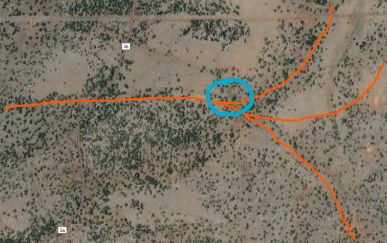
The area is accessible from Interstate 40 at Bellemont, or from Highway 180 out of Flagstaff. The main forest roads are reasonably maintained, but a high clearance 4X4 is recommended. During the winter months, the area is closed.
From Bellemont, take FR171 north. New housing developments are slowly covering the old mill site of the Edward Ayers company. The forest road is built on the old railroad bed. Continuing north, look for the signs showing the way to the Lava River Cave. You can hike and climb into the cave complex, but be prepared for a cold, dark experience. This is for experienced, group hikers. There is safety in numbers. You can check with the Forest Service for access hours and further information.
From Highway 180 you can drive west on several forest roads connecting with the highway. Always carry a good forest road map and be prepared for rough roads.